Toggle navigation
Survey Documents
Advanced Search
Supporting Data
Companies
Surveyors
Communities
Original Townships
APIs
Survey Documents API
Tutorial
About
Contact
Search
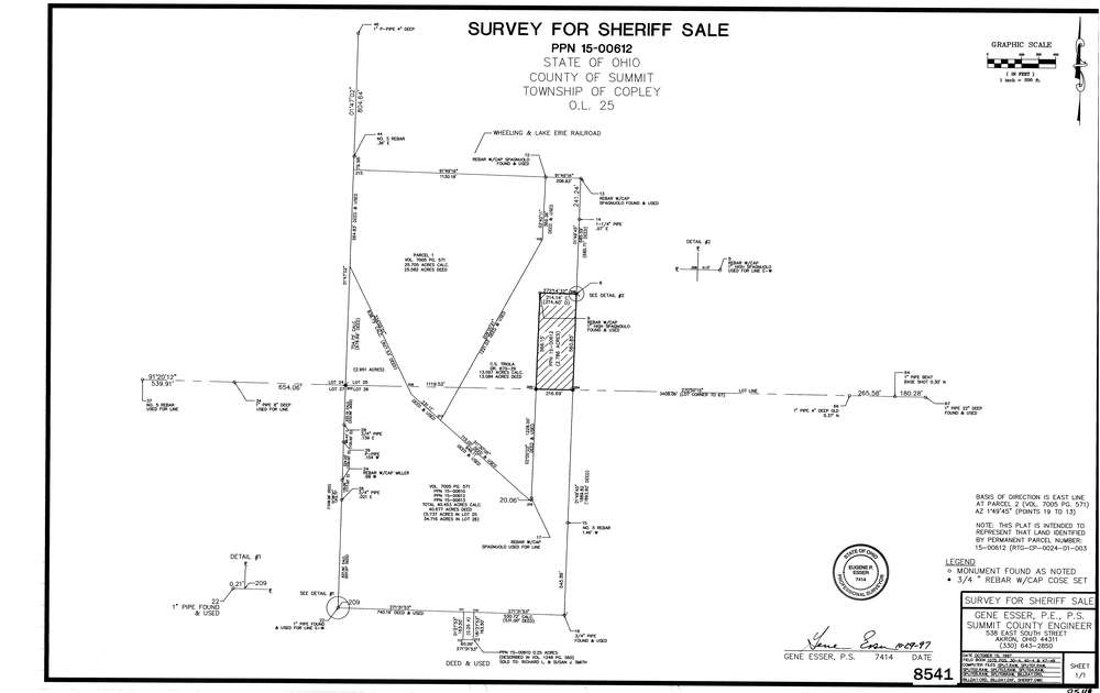
8541
Download lotsplits8541.tif
GIS Data
Latitude:
41.0994209999999
Longitude:
-81.606896
Identification
Survey identifier:
8541
Context
Original township:
Copley
Community list:
Copley
Surveyed on:
10/15/1997
Description
Owner:
Description:
Primary road:
Schocalog Rd
Secondary road:
Near intersection:
Acreage:
2.786
Survey Locators
Tract list:
Lot list:
25, 26
Section list:
Quarter:
Surveyor
Surveyor number:
7414
Surveyor name:
Esser, Eugene P.
Company:
County Of Summit Engineers
Document Data
Scan File Name:
lotsplits8541.tif
Scan Pages:
1
Drawer location: