Toggle navigation
Survey Documents
Advanced Search
Supporting Data
Companies
Surveyors
Communities
Original Townships
APIs
Survey Documents API
Tutorial
About
Contact
Search
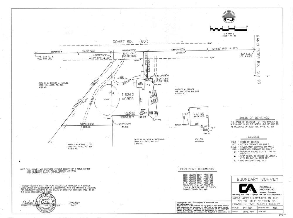
8552
Download lotsplits8552.tif
GIS Data
Latitude:
40.9184739999999
Longitude:
-81.56662
Identification
Survey identifier:
8552
Context
Original township:
Franklin
Community list:
Franklin
Surveyed on:
10/17/1997
Description
Owner:
Description:
Primary road:
Comet Rd
Secondary road:
Near intersection:
Manchester Rd
Acreage:
1.6262
Survey Locators
Tract list:
Lot list:
Section list:
35
Quarter:
Surveyor
Surveyor number:
7528
Surveyor name:
Durbin, Michael E.
Company:
Campbell & Associates
Document Data
Scan File Name:
lotsplits8552.tif
Scan Pages:
1
Drawer location: