Toggle navigation
Survey Documents
Advanced Search
Supporting Data
Companies
Surveyors
Communities
Original Townships
APIs
Survey Documents API
Tutorial
About
Contact
Search
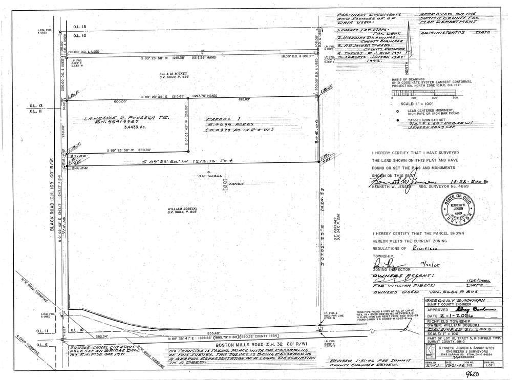
9620
Download lotsplits9620.tif
GIS Data
Latitude:
41.2649689999999
Longitude:
-81.606617
Identification
Survey identifier:
9620
Context
Original township:
Richfield
Community list:
Richfield
Surveyed on:
12/28/2005
Description
Owner:
William Sobecki
Description:
Primary road:
Black Rd
Secondary road:
Black Rd
Near intersection:
Boston Miills Rd
Acreage:
5.0699
Survey Locators
Tract list:
5
Lot list:
10
Section list:
Quarter:
Surveyor
Surveyor number:
7273
Surveyor name:
Jensen, David L.
Company:
Kenneth Jensen & Associates
Document Data
Scan File Name:
lotsplits9620.tif
Scan Pages:
1
Drawer location: