Toggle navigation
Survey Documents
Advanced Search
Supporting Data
Companies
Surveyors
Communities
Original Townships
APIs
Survey Documents API
Tutorial
About
Contact
Search
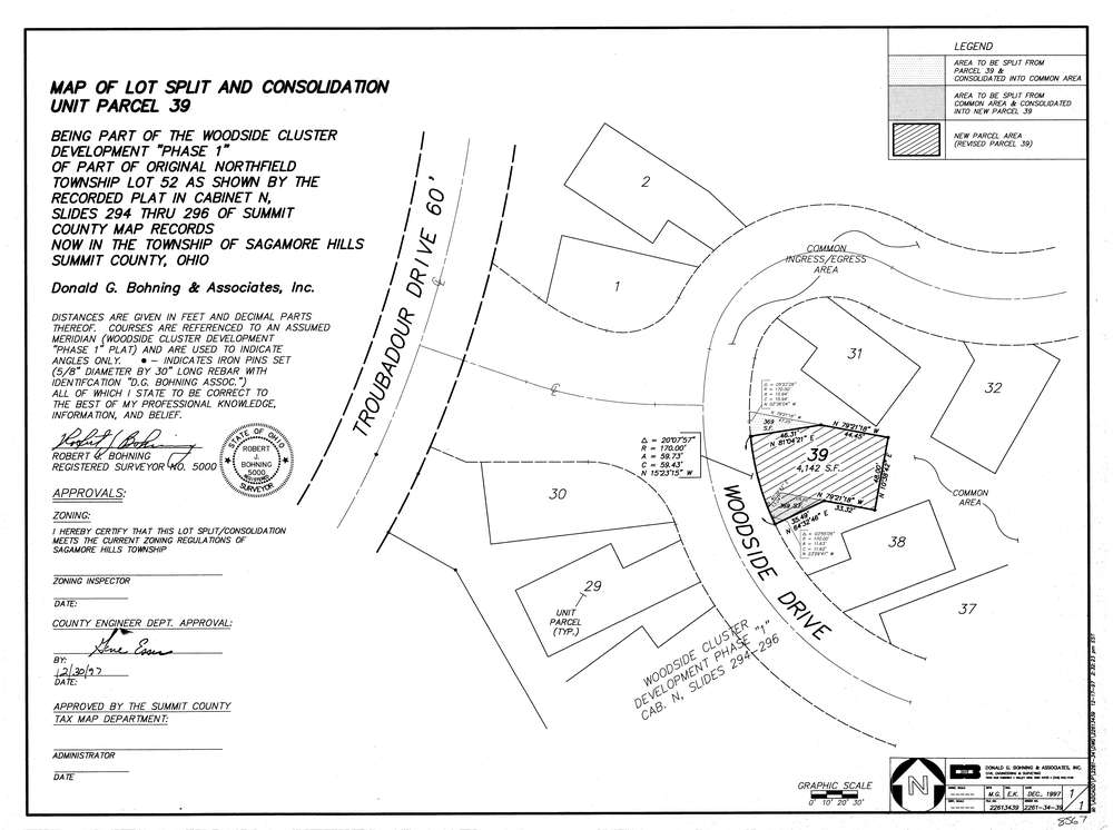
8567
Download lotsplits8567.tif
GIS Data
Latitude:
41.3372599999999
Longitude:
-81.54689
Identification
Survey identifier:
8567
Context
Original township:
Northfield
Community list:
Sagamore Hills
Surveyed on:
12/01/1997
Description
Owner:
Description:
Woodside Cluster Development #1 Cab."N" Slides 294 296
Primary road:
Woodside Dr
Secondary road:
Near intersection:
Troubadour Dr
Acreage:
Survey Locators
Tract list:
Lot list:
52
Section list:
Quarter:
Surveyor
Surveyor number:
5000
Surveyor name:
Bohning, Robert J.
Company:
Donald G. Bohning & Associates, Inc.
Document Data
Scan File Name:
lotsplits8567.tif
Scan Pages:
1
Drawer location: