Toggle navigation
Survey Documents
Advanced Search
Supporting Data
Companies
Surveyors
Communities
Original Townships
APIs
Survey Documents API
Tutorial
About
Contact
Search
8610
Download lotsplits8610.tif
GIS Data
Latitude:
40.9960789999998
Longitude:
-81.535614
Identification
Survey identifier:
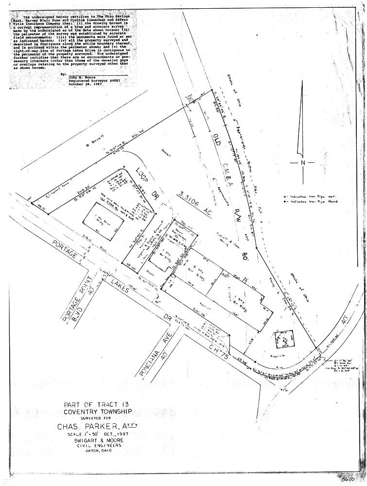
8610
Context
Original township:
Coventry
Community list:
Coventry
Surveyed on:
10/01/1987
Description
Owner:
Description:
Primary road:
Portage Lakes Dr
Secondary road:
Near intersection:
Portage Point Blvd
Acreage:
3.3106
Survey Locators
Tract list:
Lot list:
Section list:
Quarter:
Surveyor
Surveyor number:
4883
Surveyor name:
Moore, John M.
Company:
Swigart & Moore
Document Data
Scan File Name:
lotsplits8610.tif
Scan Pages:
1
Drawer location: