Toggle navigation
Survey Documents
Advanced Search
Supporting Data
Companies
Surveyors
Communities
Original Townships
APIs
Survey Documents API
Tutorial
About
Contact
Search
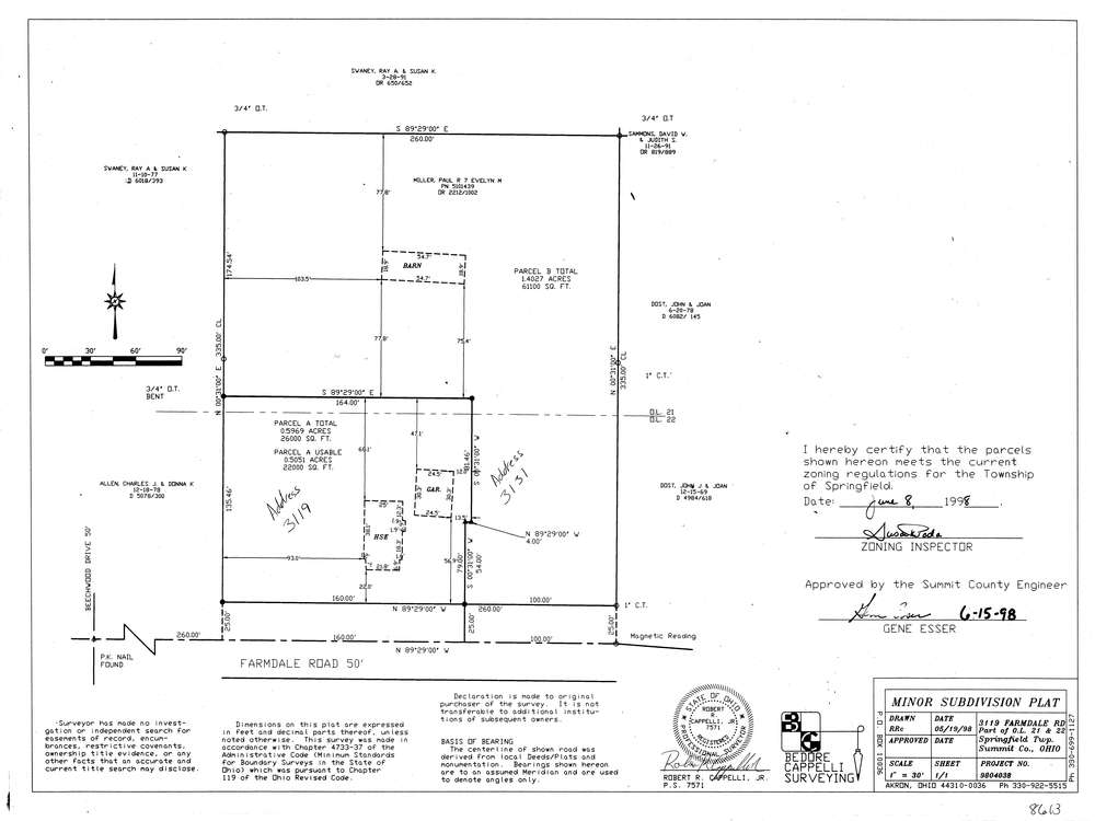
8613
Download lotsplits8613.tif
GIS Data
Latitude:
41.0353569999998
Longitude:
-81.414399
Identification
Survey identifier:
8613
Context
Original township:
Springfield
Community list:
Springfield
Surveyed on:
05/19/1998
Description
Owner:
Description:
Primary road:
Farmdale Rd
Secondary road:
Near intersection:
Beechwood Dr
Acreage:
0.5969
Survey Locators
Tract list:
Lot list:
21, 22
Section list:
Quarter:
Surveyor
Surveyor number:
7571
Surveyor name:
Cappelli, Robert R. Jr.
Company:
Document Data
Scan File Name:
lotsplits8613.tif
Scan Pages:
1
Drawer location: