Toggle navigation
Survey Documents
Advanced Search
Supporting Data
Companies
Surveyors
Communities
Original Townships
APIs
Survey Documents API
Tutorial
About
Contact
Search
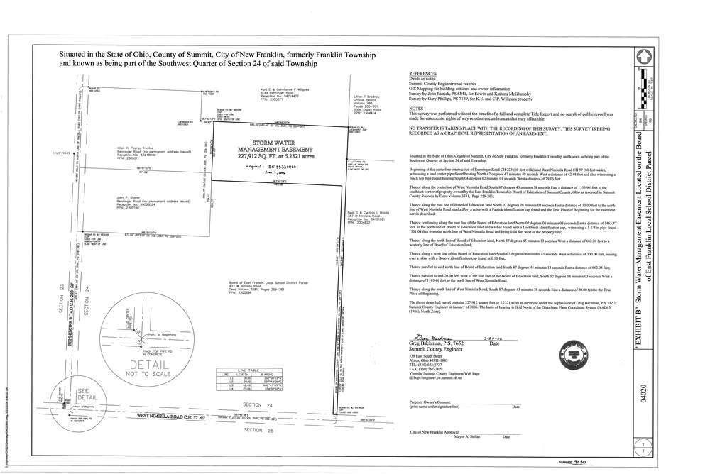
9630
Download survey_9630.tif
GIS Data
Latitude:
40.9436019999998
Longitude:
-81.550655
Identification
Survey identifier:
9630
Context
Original township:
Franklin
Community list:
Franklin
Surveyed on:
03/24/2006
Description
Owner:
East Franklin School Board
Description:
Primary road:
Nimisila Rd
Secondary road:
Nimisila Rd
Near intersection:
Renninger Rd
Acreage:
5.2321
Survey Locators
Tract list:
Lot list:
Section list:
24
Quarter:
SW
Surveyor
Surveyor number:
7652
Surveyor name:
Bachman, Gregory
Company:
County Of Summit Engineers
Document Data
Scan File Name:
survey_9630.tif
Scan Pages:
1
Drawer location: