Toggle navigation
Survey Documents
Advanced Search
Supporting Data
Companies
Surveyors
Communities
Original Townships
APIs
Survey Documents API
Tutorial
About
Contact
Search
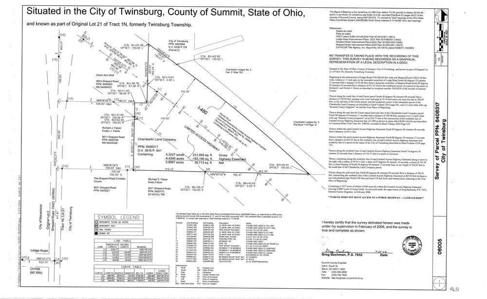
9631
Download lotsplits9631.tif
GIS Data
Latitude:
41.3355119999999
Longitude:
-81.484115
Identification
Survey identifier:
9631
Context
Original township:
Twinsburg
Community list:
Twinsburg
Surveyed on:
03/24/2006
Description
Owner:
Chamberlin Land Co
Description:
Primary road:
Shepard Rd
Secondary road:
I 480
Near intersection:
Ledge Rd
Acreage:
5.3227
Survey Locators
Tract list:
1N
Lot list:
21
Section list:
Quarter:
Surveyor
Surveyor number:
7652
Surveyor name:
Bachman, Gregory
Company:
County Of Summit Engineers
Document Data
Scan File Name:
lotsplits9631.tif
Scan Pages:
1
Drawer location: