Toggle navigation
Survey Documents
Advanced Search
Supporting Data
Companies
Surveyors
Communities
Original Townships
APIs
Survey Documents API
Tutorial
About
Contact
Search
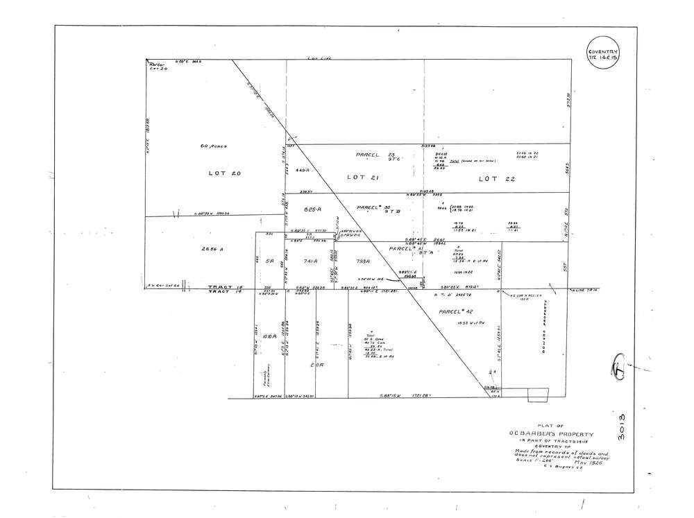
3013
Download lotsplits3013.tif
GIS Data
Latitude:
41.0061359999998
Longitude:
-81.565504
Identification
Survey identifier:
3013
Context
Original township:
Coventry
Community list:
Coventry
Surveyed on:
Description
Owner:
Barber
Description:
Made From Records Of Deeds And Does Not Represent Actual Survey
Primary road:
State St
Secondary road:
Near intersection:
Lockwood Rd
Acreage:
Survey Locators
Tract list:
14, 15
Lot list:
20, 21, 22
Section list:
Quarter:
Surveyor
Surveyor number:
603
Surveyor name:
Bushey, C.L.
Company:
Document Data
Scan File Name:
lotsplits3013.tif
Scan Pages:
1
Drawer location: