Toggle navigation
Survey Documents
Advanced Search
Supporting Data
Companies
Surveyors
Communities
Original Townships
APIs
Survey Documents API
Tutorial
About
Contact
Search
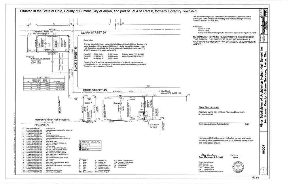
9639
Download lotsplits9639.tif
GIS Data
Latitude:
41.0653419999999
Longitude:
-81.496603
Identification
Survey identifier:
9639
Context
Original township:
Portage
Community list:
Akron
Surveyed on:
06/12/2006
Description
Owner:
Hoban High School
Description:
Primary road:
Edge St
Secondary road:
Clark St
Near intersection:
Black St
Acreage:
Survey Locators
Tract list:
8
Lot list:
4
Section list:
Quarter:
Surveyor
Surveyor number:
7652
Surveyor name:
Bachman, Gregory
Company:
County Of Summit Engineers
Document Data
Scan File Name:
lotsplits9639.tif
Scan Pages:
1
Drawer location: