Toggle navigation
Survey Documents
Advanced Search
Supporting Data
Companies
Surveyors
Communities
Original Townships
APIs
Survey Documents API
Tutorial
About
Contact
Search
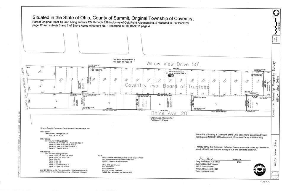
9550
Download lotsplits9550.tif
GIS Data
Latitude:
40.9904208999999
Longitude:
-81.5325598
Identification
Survey identifier:
9550
Context
Original township:
Coventry
Community list:
Coventry
Surveyed on:
05/10/2005
Description
Owner:
Coventry Twp. Board Of Trustees
Description:
Primary road:
Willow View Dr
Secondary road:
Rhine Ave
Near intersection:
South Turkeyfoot
Acreage:
Survey Locators
Tract list:
13
Lot list:
Section list:
Quarter:
Surveyor
Surveyor number:
7652
Surveyor name:
Bachman, Gregory
Company:
County Of Summit Engineer
Document Data
Scan File Name:
lotsplits9550.tif
Scan Pages:
1
Drawer location: