Toggle navigation
Survey Documents
Advanced Search
Supporting Data
Companies
Surveyors
Communities
Original Townships
APIs
Survey Documents API
Tutorial
About
Contact
Search
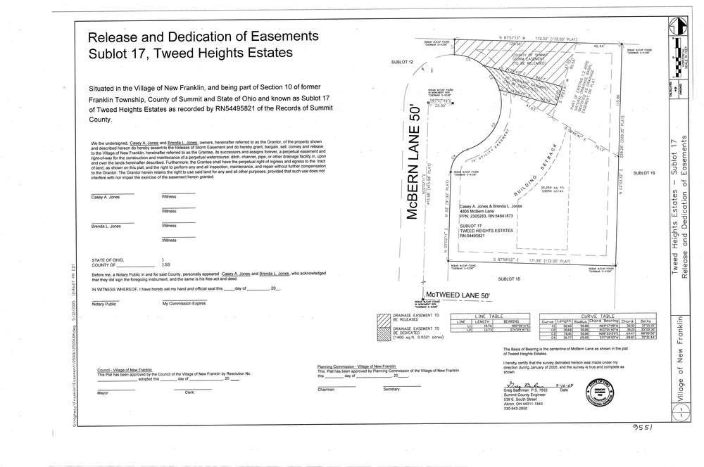
9551
Download lotsplits9551.tif
GIS Data
Latitude:
40.9776941999999
Longitude:
-81.5736466
Identification
Survey identifier:
9551
Context
Original township:
Franklin
Community list:
Franklin
Surveyed on:
05/10/2005
Description
Owner:
Jones
Description:
Release And Dedication Of Easements Sublot 17, Tweed Heights Estates
Primary road:
Mc Tweed Ln
Secondary road:
Near intersection:
Mc Bern Ln
Acreage:
Survey Locators
Tract list:
Lot list:
Section list:
10
Quarter:
Surveyor
Surveyor number:
7652
Surveyor name:
Bachman, Gregory
Company:
County Of Summit Engineer
Document Data
Scan File Name:
lotsplits9551.tif
Scan Pages:
1
Drawer location: