Toggle navigation
Survey Documents
Advanced Search
Supporting Data
Companies
Surveyors
Communities
Original Townships
APIs
Survey Documents API
Tutorial
About
Contact
Search
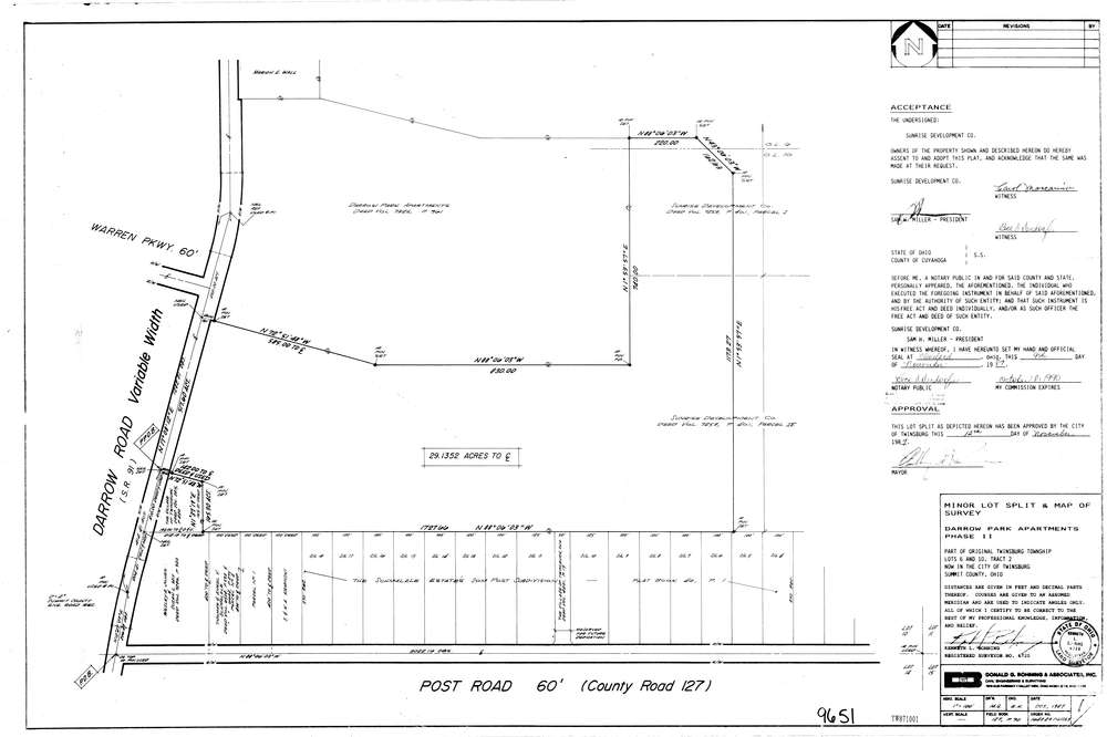
9651
Download lotsplits_9651.tif
GIS Data
Latitude:
41.3348829999999
Longitude:
-81.437724
Identification
Survey identifier:
9651
Context
Original township:
Twinsburg
Community list:
Twinsburg
Surveyed on:
11/12/1987
Description
Owner:
Sunrise Development Co
Description:
Primary road:
Post Rd
Secondary road:
Darrow Rd
Near intersection:
Acreage:
29.1352
Survey Locators
Tract list:
2
Lot list:
10, 6
Section list:
Quarter:
Surveyor
Surveyor number:
6720
Surveyor name:
Bohning, Kenneth L.
Company:
Donald G. Bohning & Associates, Inc.
Document Data
Scan File Name:
lotsplits_9651.tif
Scan Pages:
1
Drawer location: