Toggle navigation
Survey Documents
Advanced Search
Supporting Data
Companies
Surveyors
Communities
Original Townships
APIs
Survey Documents API
Tutorial
About
Contact
Search
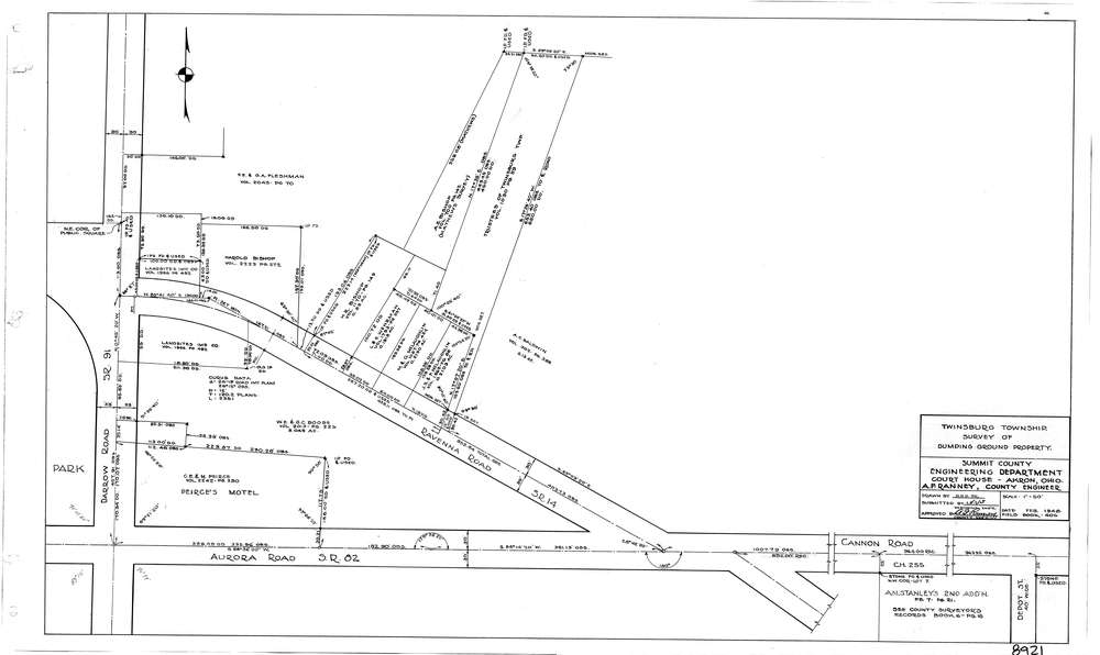
8921
Download lotsplits8921.tif
GIS Data
Latitude:
41.3124679999999
Longitude:
-81.438475
Identification
Survey identifier:
8921
Context
Original township:
Twinsburg
Community list:
Twinsburg
Surveyed on:
02/29/1948
Description
Owner:
Description:
Primary road:
Ravenna Rd
Secondary road:
Aurora Rd
Near intersection:
Darrow Rd
Acreage:
9.0002
Survey Locators
Tract list:
Lot list:
Section list:
Quarter:
Surveyor
Surveyor number:
COSE15
Surveyor name:
Ranney, A.F.
Company:
County Of Summit Engineer
Document Data
Scan File Name:
lotsplits8921.tif
Scan Pages:
1
Drawer location: