Toggle navigation
Survey Documents
Advanced Search
Supporting Data
Companies
Surveyors
Communities
Original Townships
APIs
Survey Documents API
Tutorial
About
Contact
Search
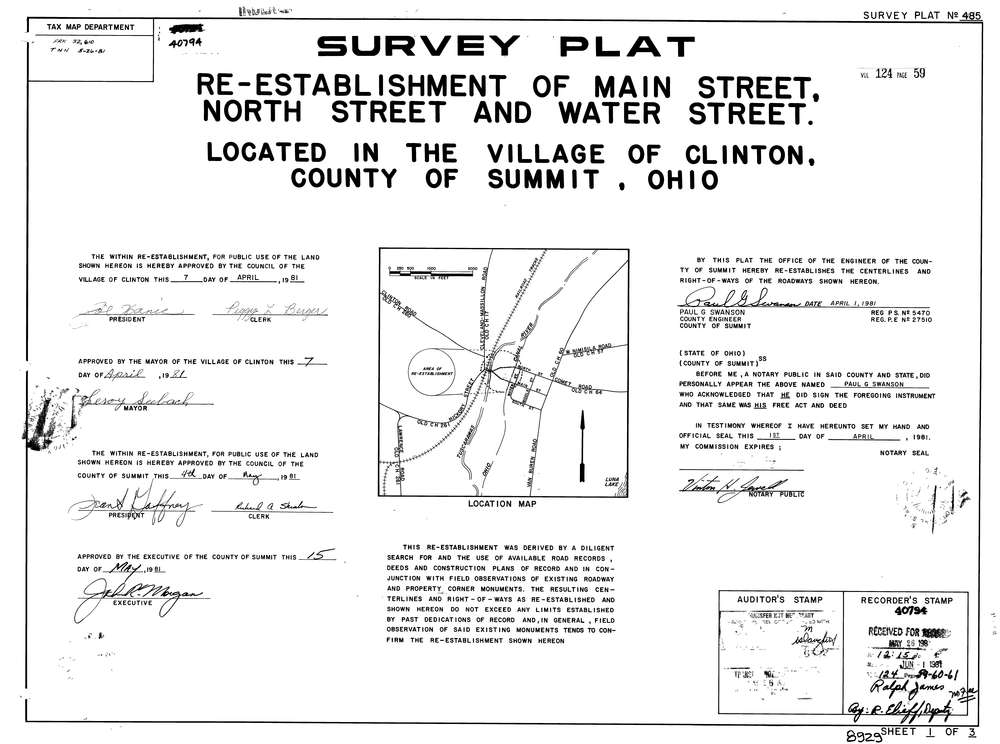
8929 3 pages scanned, please download to view all scans
Download lotsplits8929.tif
GIS Data
Latitude:
40.9281049999999
Longitude:
-81.631336
Identification
Survey identifier:
8929
Context
Original township:
Franklin
Community list:
Clinton, Franklin
Surveyed on:
04/01/1981
Description
Owner:
Description:
Re Establishment Of Main, North & Water Streets
Primary road:
Main St
Secondary road:
Near intersection:
North St
Acreage:
Survey Locators
Tract list:
Lot list:
Section list:
Quarter:
Surveyor
Surveyor number:
5470
Surveyor name:
Swanson, Paul G.
Company:
County Of Summit Engineers
Document Data
Scan File Name:
lotsplits8929.tif
Scan Pages:
3
Drawer location: