Toggle navigation
Survey Documents
Advanced Search
Supporting Data
Companies
Surveyors
Communities
Original Townships
APIs
Survey Documents API
Tutorial
About
Contact
Search
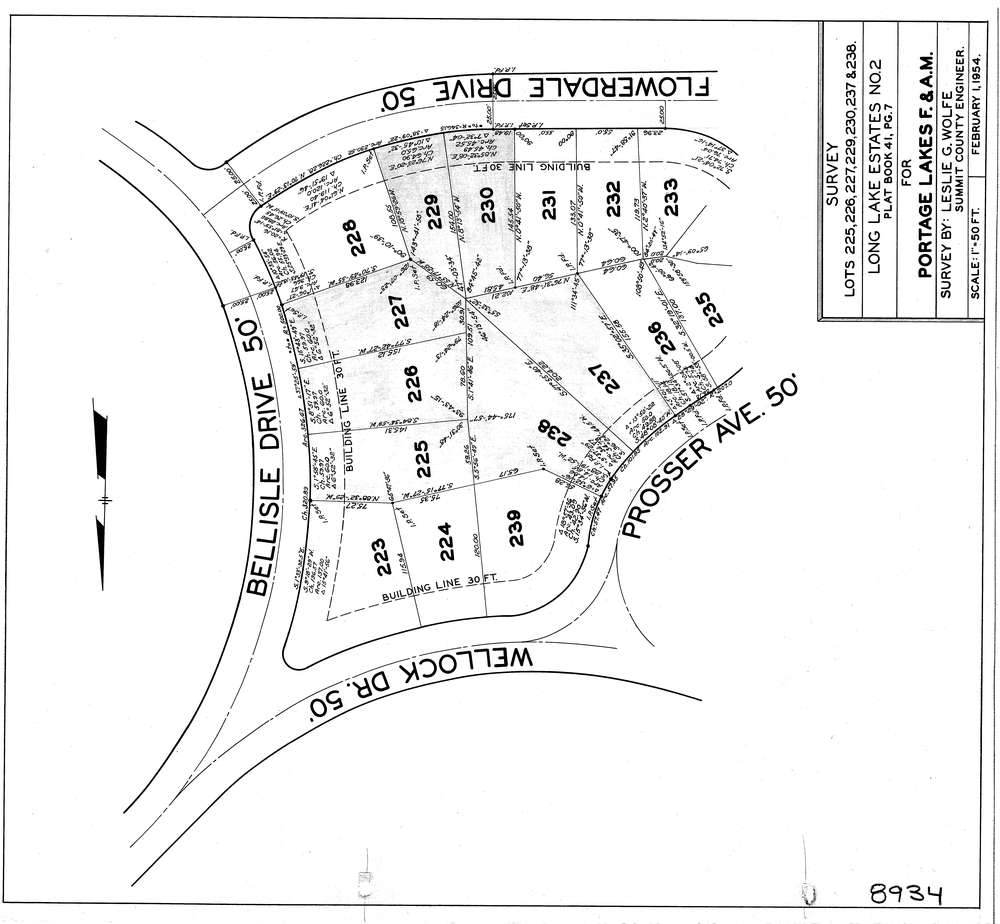
8934
Download lotsplits8934.tif
GIS Data
Latitude:
41.0043219999999
Longitude:
-81.526151
Identification
Survey identifier:
8934
Context
Original township:
Coventry
Community list:
Coventry
Surveyed on:
Description
Owner:
Description:
Survey Of Sublots 225,226,227,229,230,237,238 In Long Lake Estates P.B. 41 Pg. 7
Primary road:
Bell Isle Dr
Secondary road:
Near intersection:
Flowerdale Dr
Acreage:
Survey Locators
Tract list:
Lot list:
Section list:
Quarter:
Surveyor
Surveyor number:
2033
Surveyor name:
Wolfe, Leslie G.
Company:
County Of Summit Engineers
Document Data
Scan File Name:
lotsplits8934.tif
Scan Pages:
1
Drawer location: