Toggle navigation
Survey Documents
Advanced Search
Supporting Data
Companies
Surveyors
Communities
Original Townships
APIs
Survey Documents API
Tutorial
About
Contact
Search
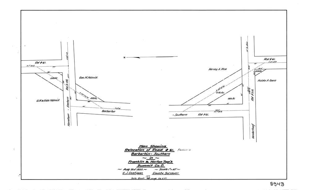
8943
Download lotsplits8943.tif
GIS Data
Latitude:
40.9838692999998
Longitude:
-81.6205039
Identification
Survey identifier:
8943
Context
Original township:
Franklin
Community list:
Franklin
Surveyed on:
08/31/2020
Description
Owner:
Description:
Relocation Plat
Primary road:
Fairland Rd
Secondary road:
Near intersection:
Vanderhoof Rd
Acreage:
Survey Locators
Tract list:
Lot list:
Section list:
Quarter:
Surveyor
Surveyor number:
COSE5
Surveyor name:
Costigan, C.J.
Company:
Document Data
Scan File Name:
lotsplits8943.tif
Scan Pages:
1
Drawer location: