Toggle navigation
Survey Documents
Advanced Search
Supporting Data
Companies
Surveyors
Communities
Original Townships
APIs
Survey Documents API
Tutorial
About
Contact
Search
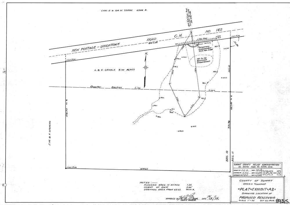
8955
Download lotsplits8955.tif
GIS Data
Latitude:
40.9740659999998
Longitude:
-81.455383
Identification
Survey identifier:
8955
Context
Original township:
Green
Community list:
Green
Surveyed on:
10/23/1934
Description
Owner:
Description:
Location Plat Of Proposed Reservoir
Primary road:
East Turkeyfoot Lake Rd
Secondary road:
Near intersection:
Dewalt Dr
Acreage:
Survey Locators
Tract list:
Lot list:
Section list:
10
Quarter:
Surveyor
Surveyor number:
Surveyor name:
Company:
County Of Summit Engineers
Document Data
Scan File Name:
lotsplits8955.tif
Scan Pages:
1
Drawer location: