Toggle navigation
Survey Documents
Advanced Search
Supporting Data
Companies
Surveyors
Communities
Original Townships
APIs
Survey Documents API
Tutorial
About
Contact
Search
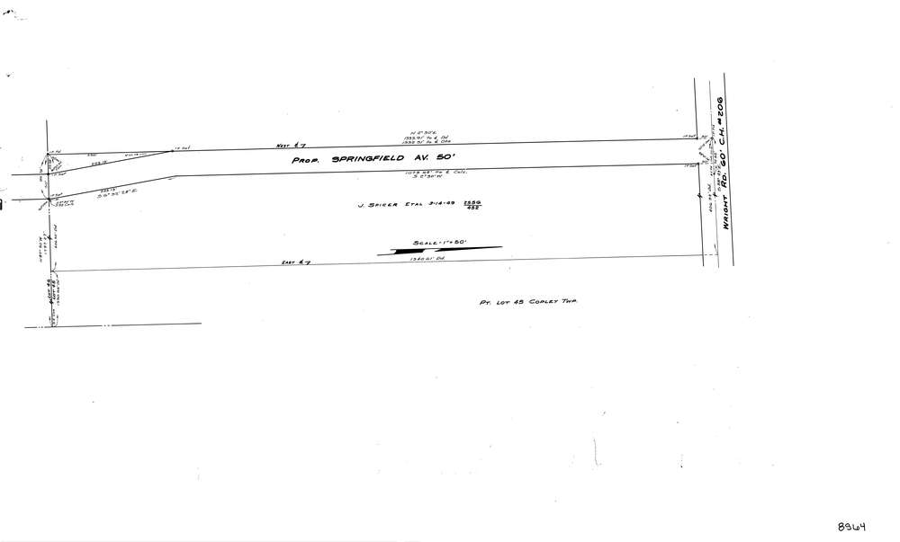
8964
Download lotsplits8964.tif
GIS Data
Latitude:
41.0723629999999
Longitude:
-81.594751
Identification
Survey identifier:
8964
Context
Original township:
Copley
Community list:
Springfield
Surveyed on:
Description
Owner:
Description:
Proposed Road
Primary road:
Wright Rd
Secondary road:
Near intersection:
Collier Rd
Acreage:
Survey Locators
Tract list:
Lot list:
45
Section list:
Quarter:
Surveyor
Surveyor number:
Surveyor name:
Company:
County Of Summit Engineers
Document Data
Scan File Name:
lotsplits8964.tif
Scan Pages:
1
Drawer location: