Toggle navigation
Survey Documents
Advanced Search
Supporting Data
Companies
Surveyors
Communities
Original Townships
APIs
Survey Documents API
Tutorial
About
Contact
Search
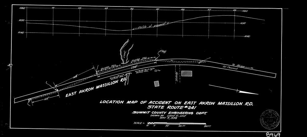
8969 2 pages scanned, please download to view all scans
Download lotsplits8969.tif
GIS Data
Latitude:
40.9941189999998
Longitude:
-81.462121
Identification
Survey identifier:
8969
Context
Original township:
Springfield
Community list:
Springfield
Surveyed on:
04/09/1937
Description
Owner:
Description:
Location Map Of Accidents
Primary road:
S.R. 241
Secondary road:
Near intersection:
Acreage:
Survey Locators
Tract list:
Lot list:
Section list:
Quarter:
Surveyor
Surveyor number:
PE-5723
Surveyor name:
Saunders, H.J.
Company:
Document Data
Scan File Name:
lotsplits8969.tif
Scan Pages:
2
Drawer location: