Toggle navigation
Survey Documents
Advanced Search
Supporting Data
Companies
Surveyors
Communities
Original Townships
APIs
Survey Documents API
Tutorial
About
Contact
Search
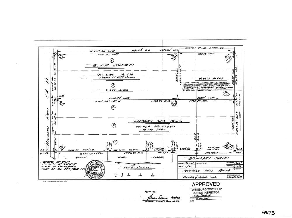
8973
Download lotsplits8973.tif
GIS Data
Latitude:
41.2984439999999
Longitude:
-81.464396
Identification
Survey identifier:
8973
Context
Original township:
Twinsburg
Community list:
Twinsburg
Surveyed on:
03/01/2000
Description
Owner:
Northern Ohio Paving
Description:
Primary road:
Highland Rd
Secondary road:
Near intersection:
Boyle Parkway
Acreage:
4.0
Survey Locators
Tract list:
1-M
Lot list:
2, 7
Section list:
Quarter:
Surveyor
Surveyor number:
6572
Surveyor name:
Polles, Gregory H.
Company:
The John David Jones Corporation
Document Data
Scan File Name:
lotsplits8973.tif
Scan Pages:
1
Drawer location: