Toggle navigation
Survey Documents
Advanced Search
Supporting Data
Companies
Surveyors
Communities
Original Townships
APIs
Survey Documents API
Tutorial
About
Contact
Search
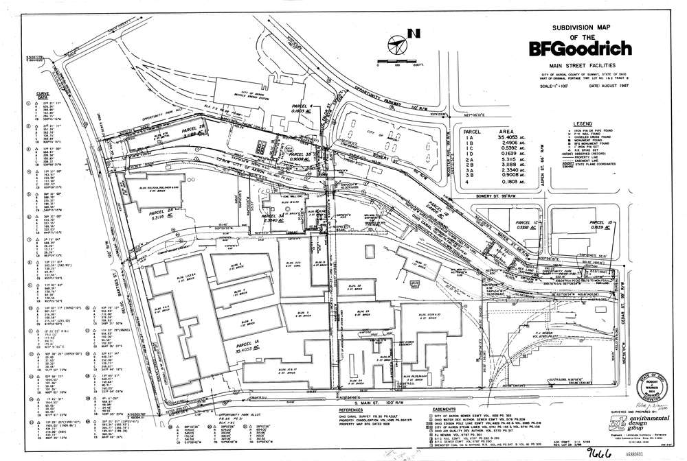
9666
Download lotsplits_9666.tif
GIS Data
Latitude:
41.0733819999999
Longitude:
-81.526923
Identification
Survey identifier:
9666
Context
Original township:
Portage
Community list:
Akron
Surveyed on:
08/01/1997
Description
Owner:
BF Goodrich
Description:
Primary road:
South Main St
Secondary road:
Ohio Canal
Near intersection:
Bartges St
Acreage:
35.4053
Survey Locators
Tract list:
8
Lot list:
1, 2
Section list:
Quarter:
Surveyor
Surveyor number:
6931
Surveyor name:
Warner, Robert J.
Company:
Environmental Design Group
Document Data
Scan File Name:
lotsplits_9666.tif
Scan Pages:
1
Drawer location: