Toggle navigation
Survey Documents
Advanced Search
Supporting Data
Companies
Surveyors
Communities
Original Townships
APIs
Survey Documents API
Tutorial
About
Contact
Search
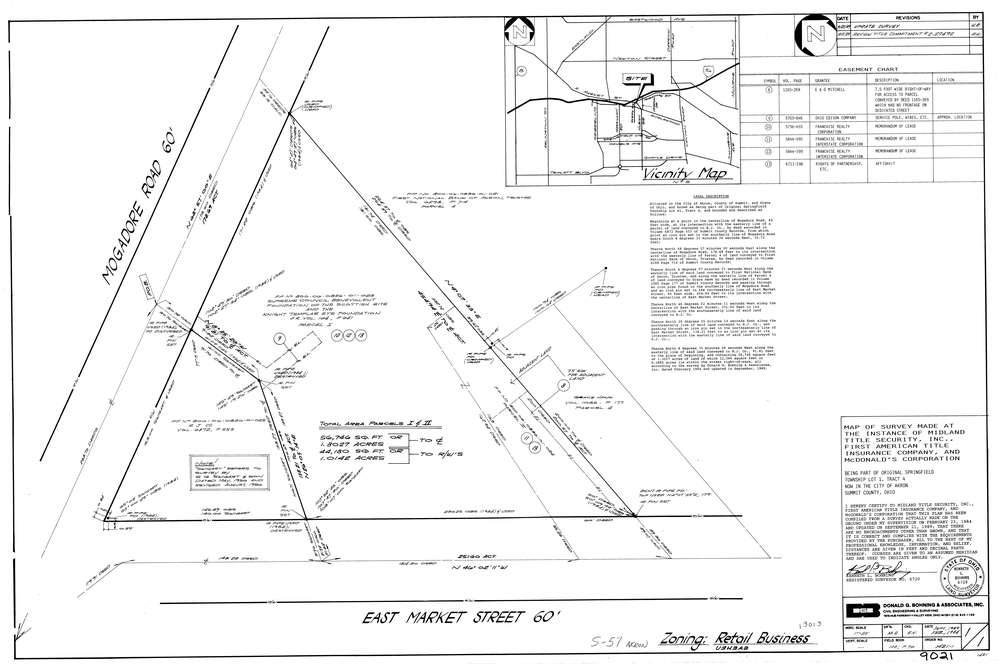
9021
Download lotsplits9021.tif
GIS Data
Latitude:
41.0611771999998
Longitude:
-81.4552106
Identification
Survey identifier:
9021
Context
Original township:
Springfield
Community list:
Akron
Surveyed on:
09/01/1989
Description
Owner:
Mcdonalds
Description:
Primary road:
East Market St
Secondary road:
Near intersection:
Mogadore Rd
Acreage:
1.3027
Survey Locators
Tract list:
4
Lot list:
1
Section list:
Quarter:
Surveyor
Surveyor number:
6720
Surveyor name:
Bohning, Kenneth L.
Company:
Donald G. Bohning & Associates, Inc.
Document Data
Scan File Name:
lotsplits9021.tif
Scan Pages:
1
Drawer location: