Toggle navigation
Survey Documents
Advanced Search
Supporting Data
Companies
Surveyors
Communities
Original Townships
APIs
Survey Documents API
Tutorial
About
Contact
Search
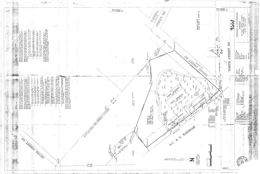
9668
Download lotsplits_9668.tif
GIS Data
Latitude:
41.0902839999998
Longitude:
-81.522117
Identification
Survey identifier:
9668
Context
Original township:
Community list:
Akron
Surveyed on:
12/01/1990
Description
Owner:
Description:
Primary road:
Ravine St
Secondary road:
A.C. & Y Railroad
Near intersection:
Tarbell St
Acreage:
1.65
Survey Locators
Tract list:
Lot list:
Section list:
Quarter:
Surveyor
Surveyor number:
5916
Surveyor name:
Butterworth, Lawrence L.
Company:
Greissing & Butterworth
Document Data
Scan File Name:
lotsplits_9668.tif
Scan Pages:
1
Drawer location: