Toggle navigation
Survey Documents
Advanced Search
Supporting Data
Companies
Surveyors
Communities
Original Townships
APIs
Survey Documents API
Tutorial
About
Contact
Search
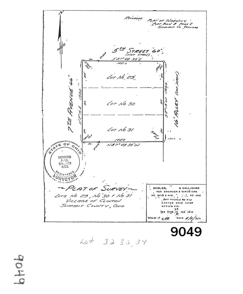
9049
Download lotsplits9049.tif
GIS Data
Latitude:
40.9271804999998
Longitude:
-81.646684
Identification
Survey identifier:
9049
Context
Original township:
Franklin
Community list:
Clinton
Surveyed on:
04/08/1971
Description
Owner:
Description:
Lots 29, 30 & 31 In Warwick P.B. 8 Pg. 2
Primary road:
Seventh Ave
Secondary road:
Near intersection:
Fifth St
Acreage:
Survey Locators
Tract list:
Lot list:
Section list:
Quarter:
Surveyor
Surveyor number:
4721
Surveyor name:
Shisler, Howard
Company:
Shisler & Galligher
Document Data
Scan File Name:
lotsplits9049.tif
Scan Pages:
1
Drawer location: