Toggle navigation
Survey Documents
Advanced Search
Supporting Data
Companies
Surveyors
Communities
Original Townships
APIs
Survey Documents API
Tutorial
About
Contact
Search
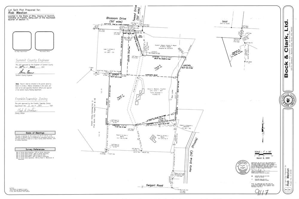
9117
Download lotsplits9117.tif
GIS Data
Latitude:
40.9761639999998
Longitude:
-81.5572238
Identification
Survey identifier:
9117
Context
Original township:
Franklin
Community list:
Franklin
Surveyed on:
03/09/2001
Description
Owner:
Weston
Description:
Primary road:
Tweed Dr
Secondary road:
Near intersection:
Blossom Dr
Acreage:
4.0584
Survey Locators
Tract list:
Lot list:
Section list:
11
Quarter:
SE
Surveyor
Surveyor number:
6943
Surveyor name:
Dorner, Robert A.
Company:
Bock & Clark
Document Data
Scan File Name:
lotsplits9117.tif
Scan Pages:
1
Drawer location: