Toggle navigation
Survey Documents
Advanced Search
Supporting Data
Companies
Surveyors
Communities
Original Townships
APIs
Survey Documents API
Tutorial
About
Contact
Search
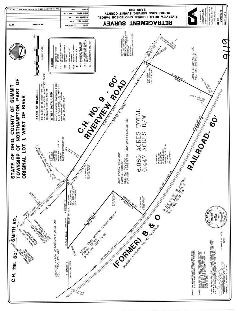
9119
Download lotsplits9119.tif
GIS Data
Latitude:
41.1374934999998
Longitude:
-81.5611614
Identification
Survey identifier:
9119
Context
Original township:
Northampton
Community list:
Cuyahoga Falls, Northampton
Surveyed on:
12/15/2000
Description
Owner:
Ohio Edison Company
Description:
Property Borders The Former B & O Railroad
Primary road:
Riverview Rd
Secondary road:
Near intersection:
Smith Rd
Acreage:
6.085
Survey Locators
Tract list:
Lot list:
1
Section list:
Quarter:
Surveyor
Surveyor number:
7495
Surveyor name:
Briggs, Timothy J.
Company:
Campbell & Associates
Document Data
Scan File Name:
lotsplits9119.tif
Scan Pages:
1
Drawer location: