Toggle navigation
Survey Documents
Advanced Search
Supporting Data
Companies
Surveyors
Communities
Original Townships
APIs
Survey Documents API
Tutorial
About
Contact
Search
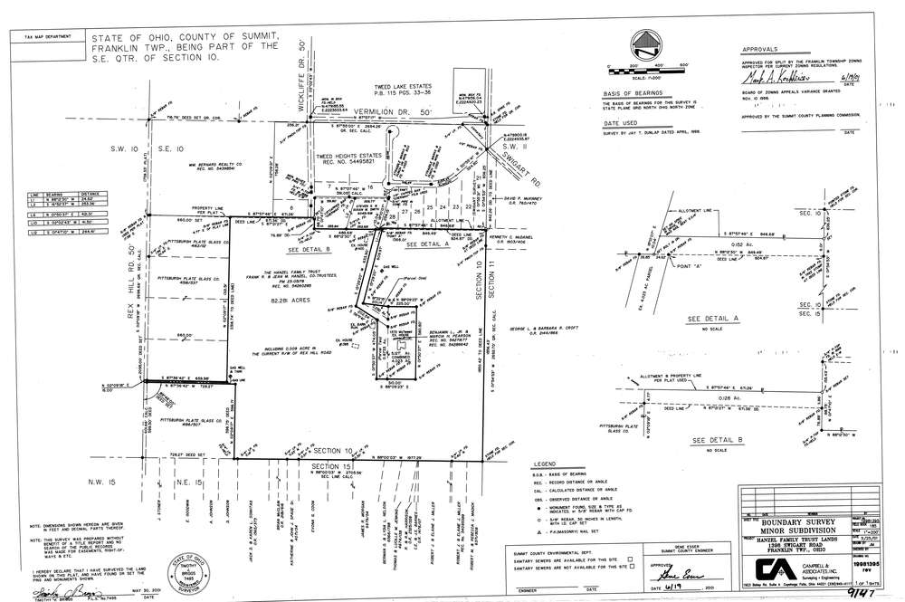
9147
Download lotsplits9147.tif
GIS Data
Latitude:
40.9735063999998
Longitude:
-81.5764191
Identification
Survey identifier:
9147
Context
Original township:
Franklin
Community list:
Franklin
Surveyed on:
05/30/2001
Description
Owner:
Hanzel Family Trust Lands
Description:
Primary road:
Vermillion Dr
Secondary road:
Near intersection:
Swigart Rd
Acreage:
0.28
Survey Locators
Tract list:
Lot list:
Section list:
10
Quarter:
Surveyor
Surveyor number:
7495
Surveyor name:
Briggs, Timothy J.
Company:
Campbell & Associates
Document Data
Scan File Name:
lotsplits9147.tif
Scan Pages:
1
Drawer location: