Toggle navigation
Survey Documents
Advanced Search
Supporting Data
Companies
Surveyors
Communities
Original Townships
APIs
Survey Documents API
Tutorial
About
Contact
Search
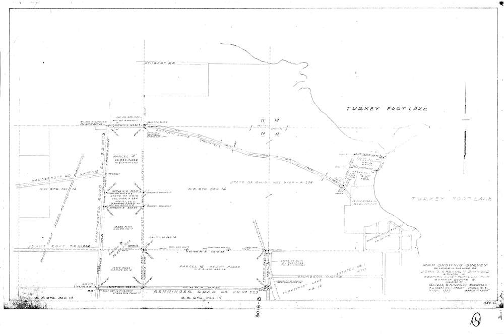
3018
Download lotsplits3018.tif
GIS Data
Latitude:
40.9659329999999
Longitude:
-81.564775
Identification
Survey identifier:
3018
Context
Original township:
Franklin
Community list:
Franklin
Surveyed on:
04/01/1957
Description
Owner:
Raymond
Description:
Primary road:
Manchester Rd
Secondary road:
Renninger Rd
Near intersection:
Johns Rd
Acreage:
Survey Locators
Tract list:
Lot list:
Section list:
14
Quarter:
Surveyor
Surveyor number:
Surveyor name:
Company:
Gehres & Kingsley, Surveyors
Document Data
Scan File Name:
lotsplits3018.tif
Scan Pages:
1
Drawer location: