Toggle navigation
Survey Documents
Advanced Search
Supporting Data
Companies
Surveyors
Communities
Original Townships
APIs
Survey Documents API
Tutorial
About
Contact
Search
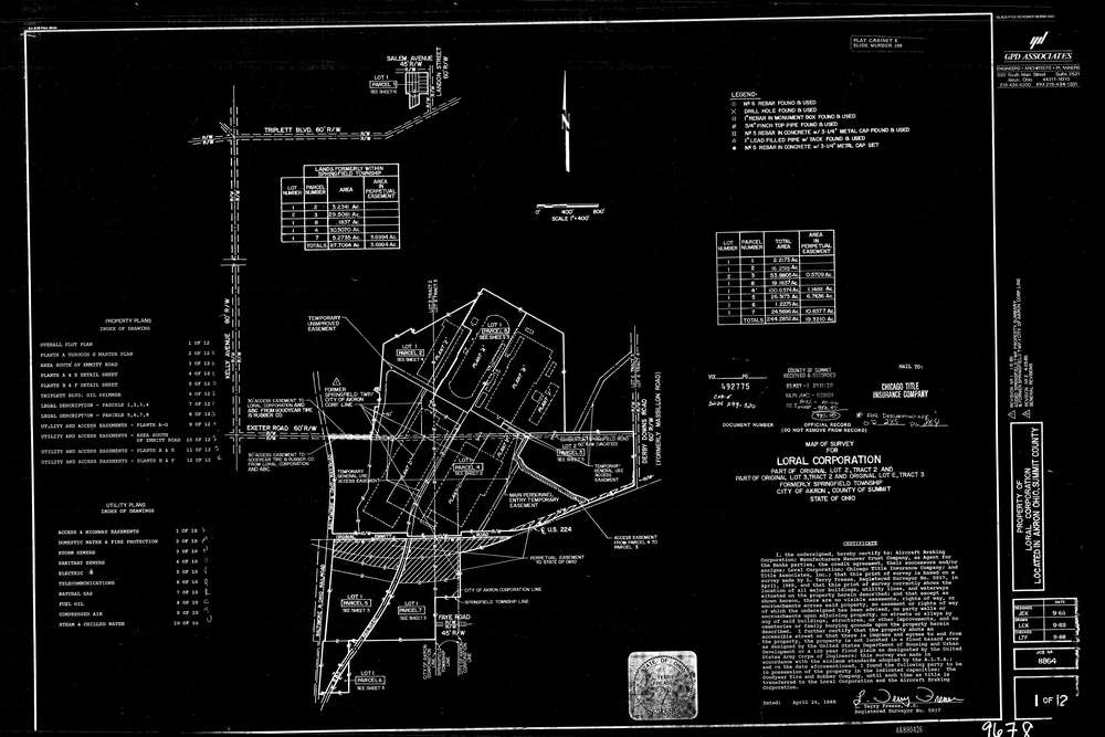
9678 12 pages scanned, please download to view all scans
Download lotsplits9678.tif
GIS Data
Latitude:
41.0270529999999
Longitude:
-81.468773
Identification
Survey identifier:
9678
Context
Original township:
Springfield
Community list:
Akron
Surveyed on:
04/26/1989
Description
Owner:
Loral Corp
Description:
See Plat CAD E Slide 299-310
Primary road:
U.S. 224
Secondary road:
Derby Downs Rd
Near intersection:
Acreage:
87.7064
Survey Locators
Tract list:
2, 3
Lot list:
2, 3
Section list:
Quarter:
Surveyor
Surveyor number:
5917
Surveyor name:
Frease, Terry L.
Company:
GPD Associates
Document Data
Scan File Name:
lotsplits9678.tif
Scan Pages:
12
Drawer location: