Toggle navigation
Survey Documents
Advanced Search
Supporting Data
Companies
Surveyors
Communities
Original Townships
APIs
Survey Documents API
Tutorial
About
Contact
Search
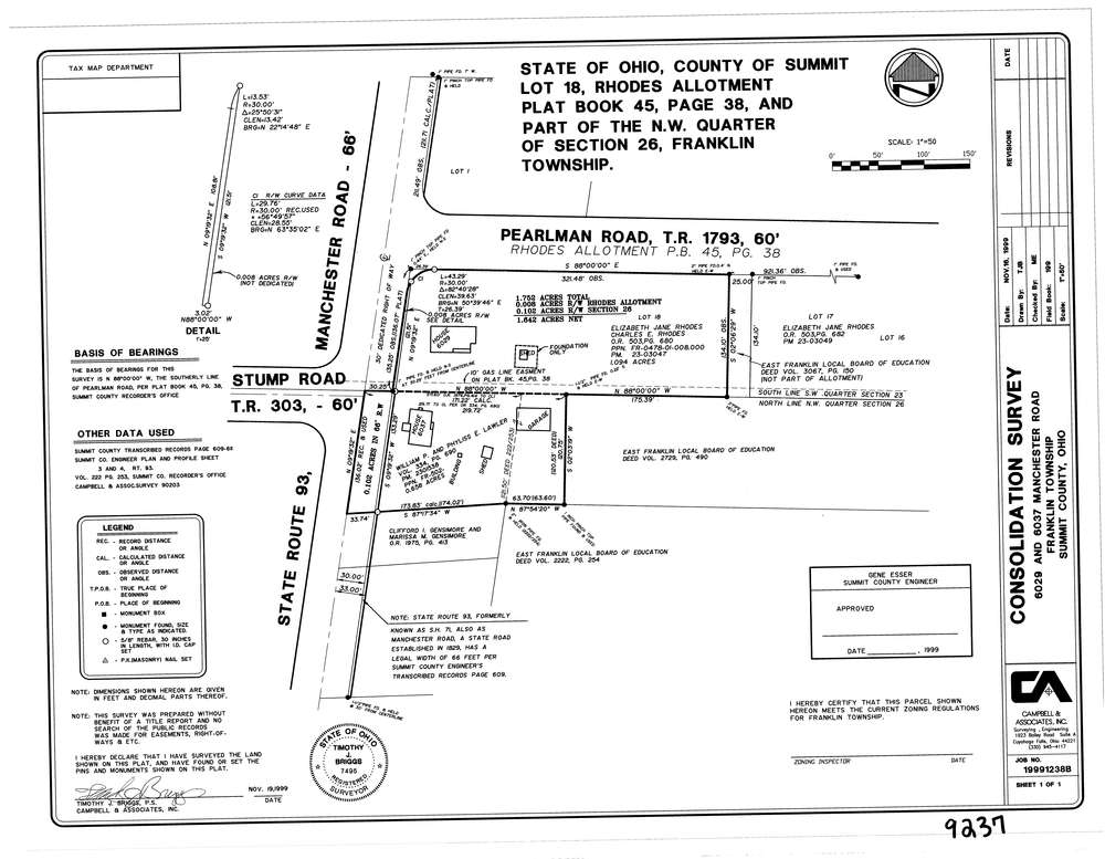
9237
Download lotsplits9237.tif
GIS Data
Latitude:
40.9409288999999
Longitude:
-81.5682327
Identification
Survey identifier:
9237
Context
Original township:
Franklin
Community list:
Franklin
Surveyed on:
11/19/1999
Description
Owner:
Lawler
Description:
Lot 18 Of Rhodes Allotment P.B. 45 Pg.38
Primary road:
Manchester Rd
Secondary road:
Pearlman Rd
Near intersection:
Stump Rd
Acreage:
1.751
Survey Locators
Tract list:
Lot list:
Section list:
26
Quarter:
NW
Surveyor
Surveyor number:
7495
Surveyor name:
Briggs, Timothy J.
Company:
Campbell & Associates
Document Data
Scan File Name:
lotsplits9237.tif
Scan Pages:
1
Drawer location: