Toggle navigation
Survey Documents
Advanced Search
Supporting Data
Companies
Surveyors
Communities
Original Townships
APIs
Survey Documents API
Tutorial
About
Contact
Search
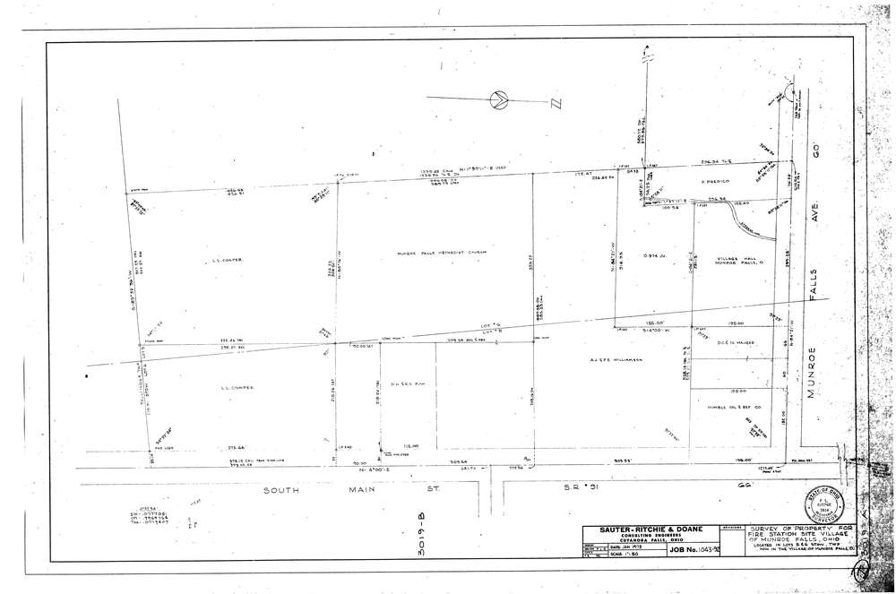
3019
Download lotsplits3019.tif
GIS Data
Latitude:
41.1383789999998
Longitude:
-81.440256
Identification
Survey identifier:
3019
Context
Original township:
Stow
Community list:
Munroe Falls
Surveyed on:
01/01/1973
Description
Owner:
Williamson, Et Al
Description:
Survey Of Property For Fire Station Site Village Of Munroe Falls
Primary road:
S.R. 91
Secondary road:
Near intersection:
Munroe Falls Ave
Acreage:
Survey Locators
Tract list:
Lot list:
5, 6
Section list:
Quarter:
Surveyor
Surveyor number:
3914
Surveyor name:
Ritchie, F.L.
Company:
Document Data
Scan File Name:
lotsplits3019.tif
Scan Pages:
1
Drawer location: