Toggle navigation
Survey Documents
Advanced Search
Supporting Data
Companies
Surveyors
Communities
Original Townships
APIs
Survey Documents API
Tutorial
About
Contact
Search
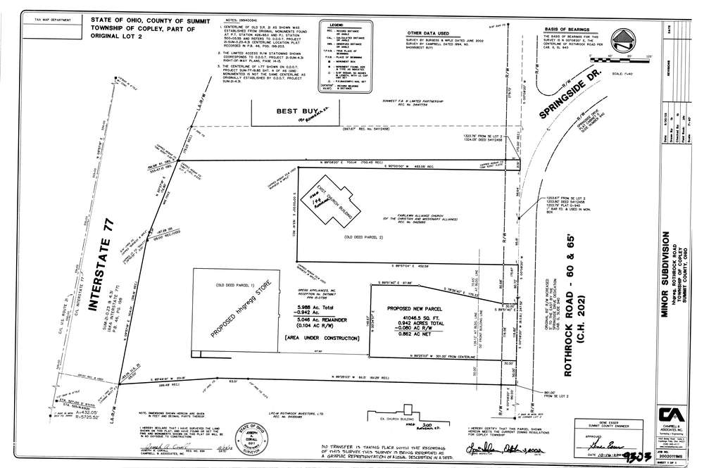
9303
Download lotsplits9303.tif
GIS Data
Latitude:
41.1315005999999
Longitude:
-81.649994
Identification
Survey identifier:
9303
Context
Original township:
Copley
Community list:
Copley
Surveyed on:
10/25/2002
Description
Owner:
Description:
Primary road:
Rothrock Rd
Secondary road:
I 77
Near intersection:
Springside Dr
Acreage:
5.988
Survey Locators
Tract list:
Lot list:
2
Section list:
Quarter:
Surveyor
Surveyor number:
6911
Surveyor name:
Corall, Joseph A.
Company:
Campbell & Associates
Document Data
Scan File Name:
lotsplits9303.tif
Scan Pages:
1
Drawer location: