Toggle navigation
Survey Documents
Advanced Search
Supporting Data
Companies
Surveyors
Communities
Original Townships
APIs
Survey Documents API
Tutorial
About
Contact
Search
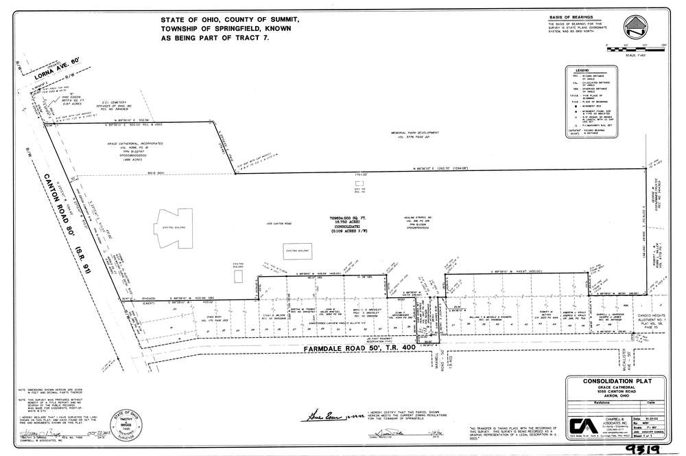
9319
Download lotsplits9319.tif
GIS Data
Latitude:
41.0360077999998
Longitude:
-81.4281927
Identification
Survey identifier:
9319
Context
Original township:
Springfield
Community list:
Springfield
Surveyed on:
12/19/2002
Description
Owner:
Description:
Primary road:
Canton Rd
Secondary road:
Farmdale Rd
Near intersection:
Acreage:
16.75
Survey Locators
Tract list:
7
Lot list:
Section list:
Quarter:
Surveyor
Surveyor number:
7495
Surveyor name:
Briggs, Timothy J.
Company:
Campbell & Associates
Document Data
Scan File Name:
lotsplits9319.tif
Scan Pages:
1
Drawer location: