Toggle navigation
Survey Documents
Advanced Search
Supporting Data
Companies
Surveyors
Communities
Original Townships
APIs
Survey Documents API
Tutorial
About
Contact
Search
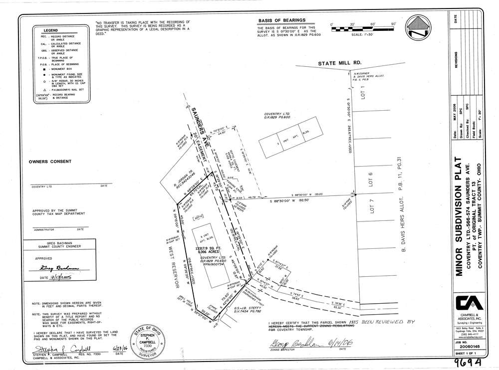
9694
Download lotsplits_9694.tif
GIS Data
Latitude:
40.9983319999998
Longitude:
-81.542968
Identification
Survey identifier:
9694
Context
Original township:
Coventry
Community list:
Coventry
Surveyed on:
07/13/2005
Description
Owner:
Coventry Limited
Description:
Primary road:
Saunders Ave
Secondary road:
Near intersection:
State Mill Rd
Acreage:
0.306
Survey Locators
Tract list:
13
Lot list:
Section list:
Quarter:
Surveyor
Surveyor number:
7330
Surveyor name:
Campbell, Stephen P.
Company:
Campbell & Associates
Document Data
Scan File Name:
lotsplits_9694.tif
Scan Pages:
1
Drawer location: