Toggle navigation
Survey Documents
Advanced Search
Supporting Data
Companies
Surveyors
Communities
Original Townships
APIs
Survey Documents API
Tutorial
About
Contact
Search
9328
Download lotsplits9328.tif
GIS Data
Latitude:
40.9540801999999
Longitude:
-81.5348134
Identification
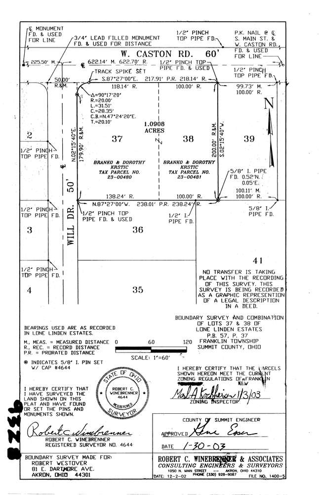
Survey identifier:
9328
Context
Original township:
Franklin
Community list:
Franklin
Surveyed on:
01/29/2003
Description
Owner:
Westover
Description:
Lone Linden Estates Lots 37,38
Primary road:
West Caston Rd
Secondary road:
Near intersection:
Will Dr
Acreage:
1.0908
Survey Locators
Tract list:
Lot list:
Section list:
Quarter:
Surveyor
Surveyor number:
4644
Surveyor name:
Winebrenner, Robert C.
Company:
Robert C. Winebrenner & Associates
Document Data
Scan File Name:
lotsplits9328.tif
Scan Pages:
1
Drawer location: