Toggle navigation
Survey Documents
Advanced Search
Supporting Data
Companies
Surveyors
Communities
Original Townships
APIs
Survey Documents API
Tutorial
About
Contact
Search
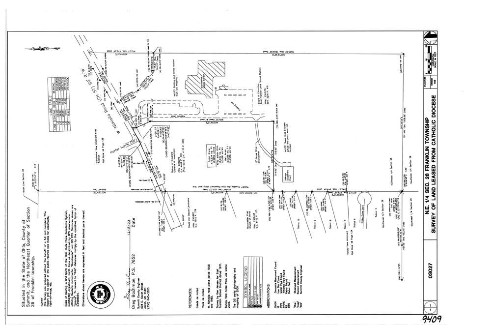
9409
Download lotsplits9409.tif
GIS Data
Latitude:
40.9364079999999
Longitude:
-81.5621989
Identification
Survey identifier:
9409
Context
Original township:
Franklin
Community list:
Franklin
Surveyed on:
12/05/2003
Description
Owner:
Catholic Diocese
Description:
Primary road:
West Nimisila Rd
Secondary road:
Near intersection:
Harter Home Dr
Acreage:
10.6358
Survey Locators
Tract list:
Lot list:
Section list:
26
Quarter:
NE
Surveyor
Surveyor number:
7652
Surveyor name:
Bachman, Gregory
Company:
County Of Summit Engineers
Document Data
Scan File Name:
lotsplits9409.tif
Scan Pages:
1
Drawer location: