Toggle navigation
Survey Documents
Advanced Search
Supporting Data
Companies
Surveyors
Communities
Original Townships
APIs
Survey Documents API
Tutorial
About
Contact
Search
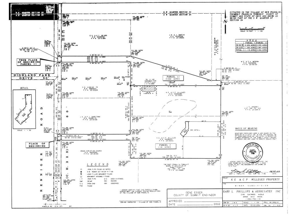
9444
Download lotsplits9444.tif
GIS Data
Latitude:
40.9460077999998
Longitude:
-81.5512728
Identification
Survey identifier:
9444
Context
Original township:
Franklin
Community list:
Franklin
Surveyed on:
05/22/2002
Description
Owner:
Willgues
Description:
Primary road:
Renninger Rd
Secondary road:
Near intersection:
Highland Park Dr
Acreage:
14.121
Survey Locators
Tract list:
Lot list:
Section list:
24
Quarter:
SW
Surveyor
Surveyor number:
7189
Surveyor name:
Phillips, Gary L.
Company:
Document Data
Scan File Name:
lotsplits9444.tif
Scan Pages:
1
Drawer location: