Toggle navigation
Survey Documents
Advanced Search
Supporting Data
Companies
Surveyors
Communities
Original Townships
APIs
Survey Documents API
Tutorial
About
Contact
Search
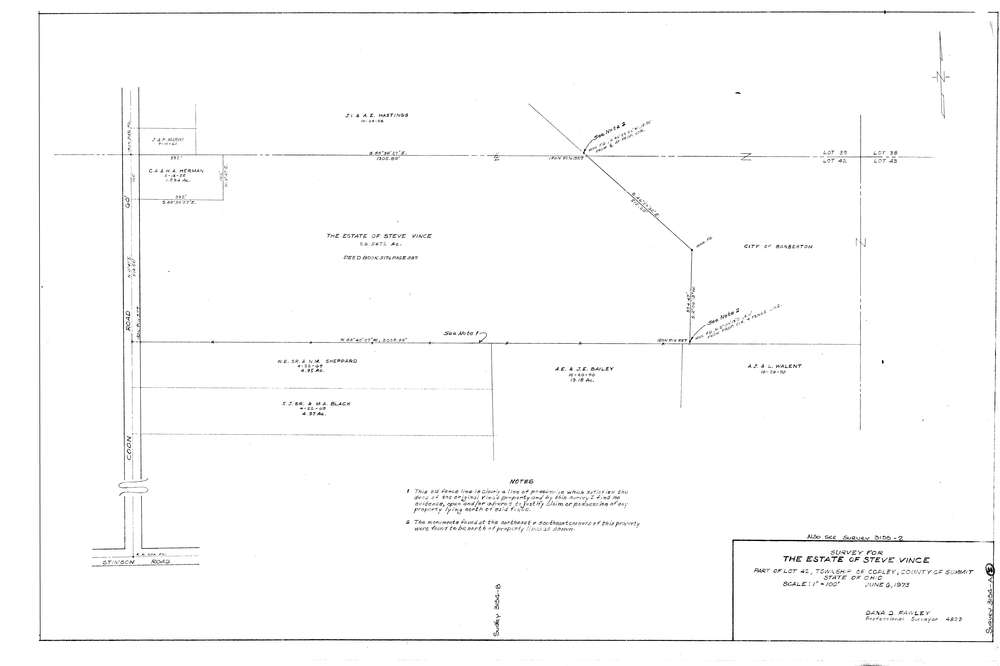
3154AB
Download lotsplits3154_ab.tif
GIS Data
Latitude:
41.0721039999999
Longitude:
-81.6576
Identification
Survey identifier:
3154AB
Context
Original township:
Copley
Community list:
Copley
Surveyed on:
06/06/1973
Description
Owner:
Vince
Description:
Primary road:
Coon Rd
Secondary road:
Near intersection:
Stimson Rd
Acreage:
28.5472
Survey Locators
Tract list:
Lot list:
42
Section list:
Quarter:
Surveyor
Surveyor number:
4829
Surveyor name:
Fawley, Dana D.
Company:
Document Data
Scan File Name:
lotsplits3154_ab.tif
Scan Pages:
1
Drawer location: