Toggle navigation
Survey Documents
Advanced Search
Supporting Data
Companies
Surveyors
Communities
Original Townships
APIs
Survey Documents API
Tutorial
About
Contact
Search
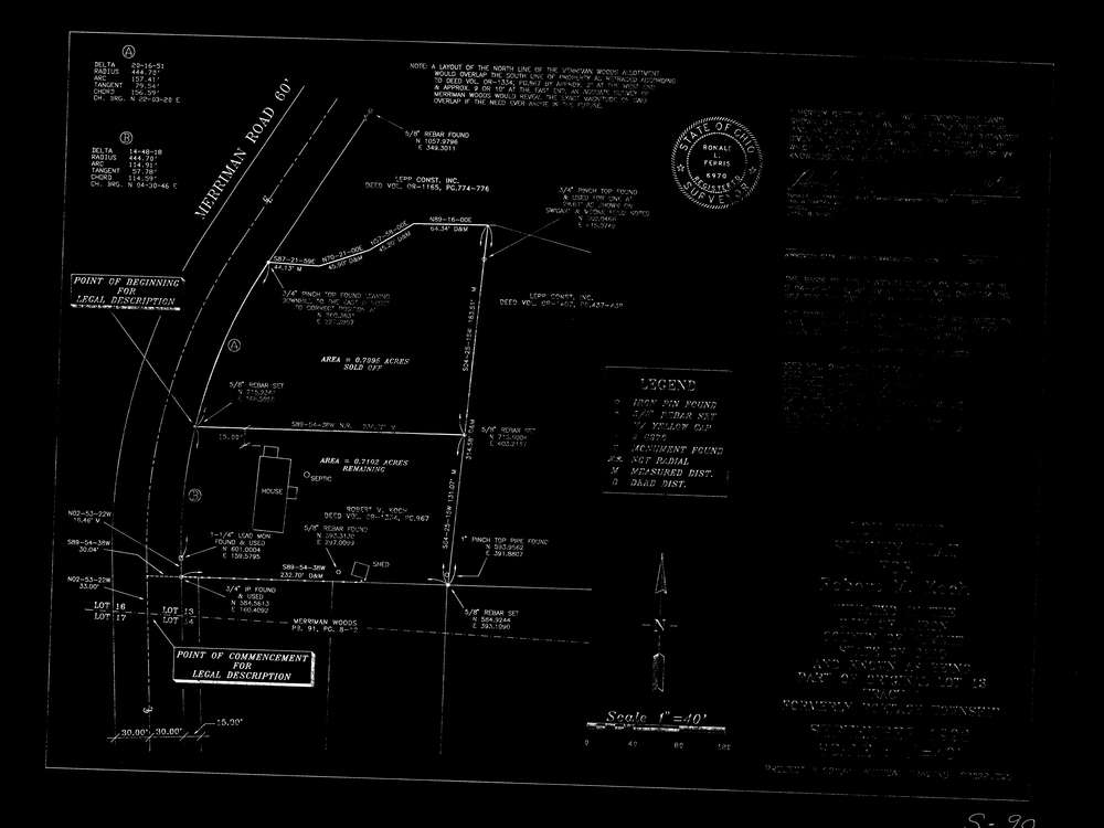
9806
Download ak_s_90.tif
GIS Data
Latitude:
41.1235259999999
Longitude:
-81.541901
Identification
Survey identifier:
9806
Context
Original township:
Portage
Community list:
Akron
Surveyed on:
09/01/1993
Description
Owner:
Koch
Description:
aks90 fiscal office survey
Primary road:
Merriman Rd
Secondary road:
Near intersection:
Monmouth Dr
Acreage:
Survey Locators
Tract list:
1
Lot list:
13
Section list:
Quarter:
Surveyor
Surveyor number:
6970
Surveyor name:
Ferris, Ronald L.
Company:
Document Data
Scan File Name:
ak_s_90.tif
Scan Pages:
1
Drawer location:
231