Toggle navigation
Survey Documents
Advanced Search
Supporting Data
Companies
Surveyors
Communities
Original Townships
APIs
Survey Documents API
Tutorial
About
Contact
Search
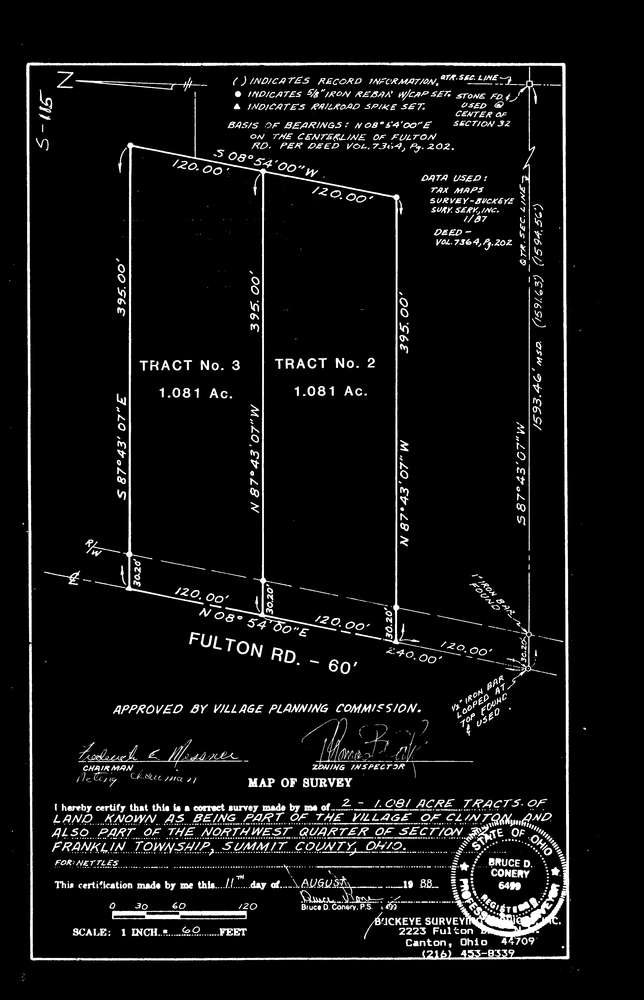
9898
Download fr_s_115.tif
GIS Data
Latitude:
40.9220409999998
Longitude:
-81.628311
Identification
Survey identifier:
9898
Context
Original township:
Franklin
Community list:
Franklin
Surveyed on:
08/11/1988
Description
Owner:
Description:
frs115 fiscal office survey
Primary road:
Fulton Rd
Secondary road:
Near intersection:
Deibel Dr
Acreage:
Survey Locators
Tract list:
Lot list:
Section list:
Quarter:
Surveyor
Surveyor number:
6499
Surveyor name:
Conery, Bruce D.
Company:
Buckeye Surveying Services, Inc.
Document Data
Scan File Name:
fr_s_115.tif
Scan Pages:
1
Drawer location:
238