Toggle navigation
Survey Documents
Advanced Search
Supporting Data
Companies
Surveyors
Communities
Original Townships
APIs
Survey Documents API
Tutorial
About
Contact
Search
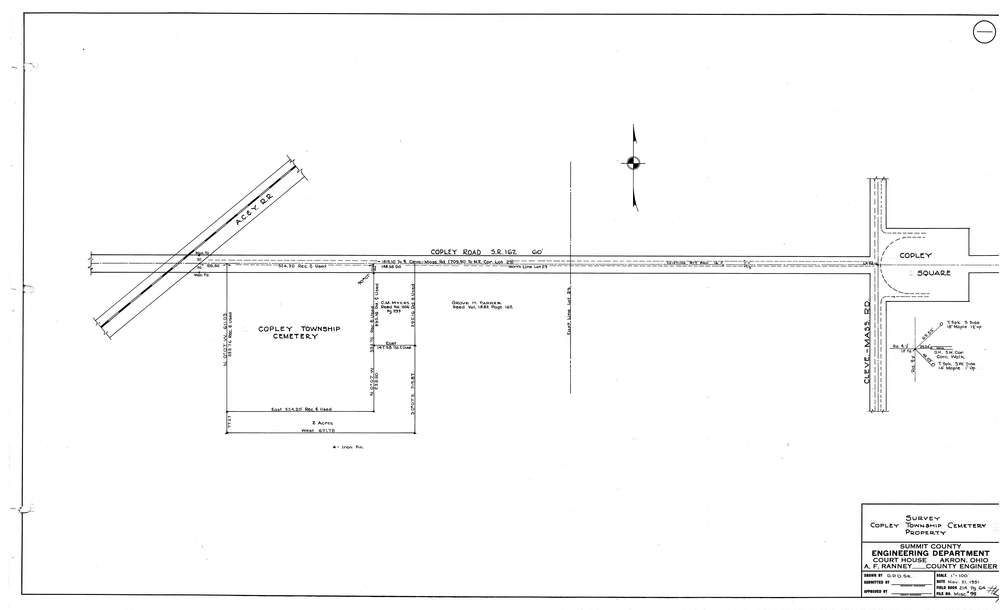
9966
Download copley002.tif
GIS Data
Latitude:
41.0986609999999
Longitude:
-81.651828
Identification
Survey identifier:
9966
Context
Original township:
Copley
Community list:
Copley
Surveyed on:
11/21/1951
Description
Owner:
Description:
Cemetery Map near the A.C. & Y. R.R.
Primary road:
Copley Rd
Secondary road:
Near intersection:
Cleveland-Massilon Rd
Acreage:
Survey Locators
Tract list:
Lot list:
Section list:
Quarter:
Surveyor
Surveyor number:
Surveyor name:
Company:
Document Data
Scan File Name:
copley002.tif
Scan Pages:
1
Drawer location:
003