Toggle navigation
Survey Documents
Advanced Search
Supporting Data
Companies
Surveyors
Communities
Original Townships
APIs
Survey Documents API
Tutorial
About
Contact
Search
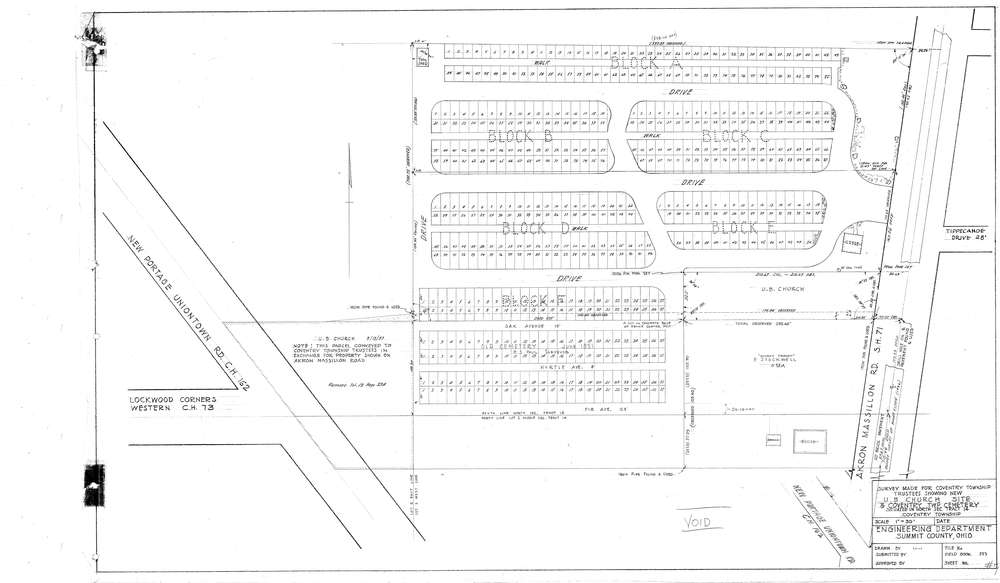
9967
Download coventry002.tif
GIS Data
Latitude:
41.0002249999998
Longitude:
-81.558326
Identification
Survey identifier:
9967
Context
Original township:
Coventry
Community list:
Coventry
Surveyed on:
Description
Owner:
Description:
Cemetery Map U.B. Church Site
Primary road:
Akron Massillon Rd
Secondary road:
Lockwood Corners Western
Near intersection:
New Portage Uniontown Rd
Acreage:
Survey Locators
Tract list:
14
Lot list:
Section list:
Quarter:
Surveyor
Surveyor number:
Surveyor name:
Company:
Document Data
Scan File Name:
coventry002.tif
Scan Pages:
1
Drawer location:
003