Toggle navigation
Survey Documents
Advanced Search
Supporting Data
Companies
Surveyors
Communities
Original Townships
APIs
Survey Documents API
Tutorial
About
Contact
Search
9969
Download eastliberty002.tif
GIS Data
Latitude:
40.9741629999998
Longitude:
-81.496432
Identification
Survey identifier:
9969
Context
Original township:
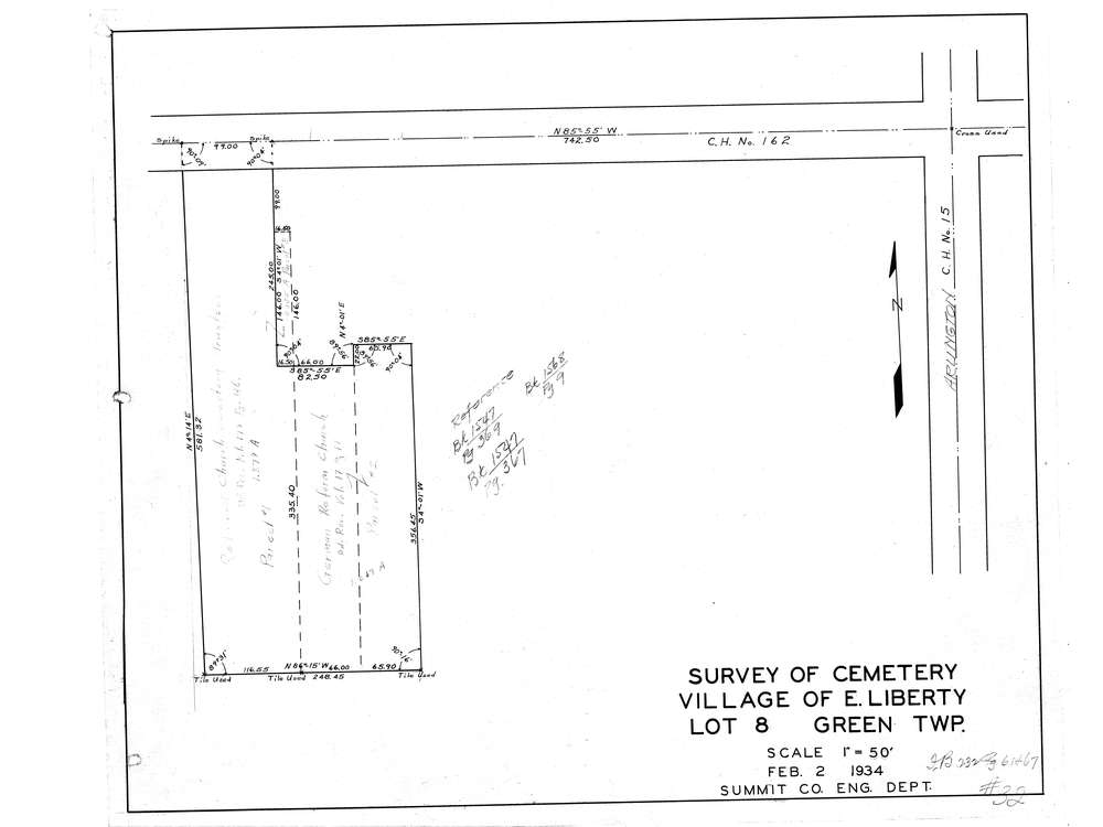
Green
Community list:
Green
Surveyed on:
02/02/1934
Description
Owner:
Description:
Cemetery Map E. Liberty
Primary road:
East Turkeyfoot Lake Rd
Secondary road:
Arlington Rd
Near intersection:
Acreage:
Survey Locators
Tract list:
Lot list:
8
Section list:
Quarter:
Surveyor
Surveyor number:
Surveyor name:
Company:
Document Data
Scan File Name:
eastliberty002.tif
Scan Pages:
1
Drawer location:
003