Toggle navigation
Survey Documents
Advanced Search
Supporting Data
Companies
Surveyors
Communities
Original Townships
APIs
Survey Documents API
Tutorial
About
Contact
Search
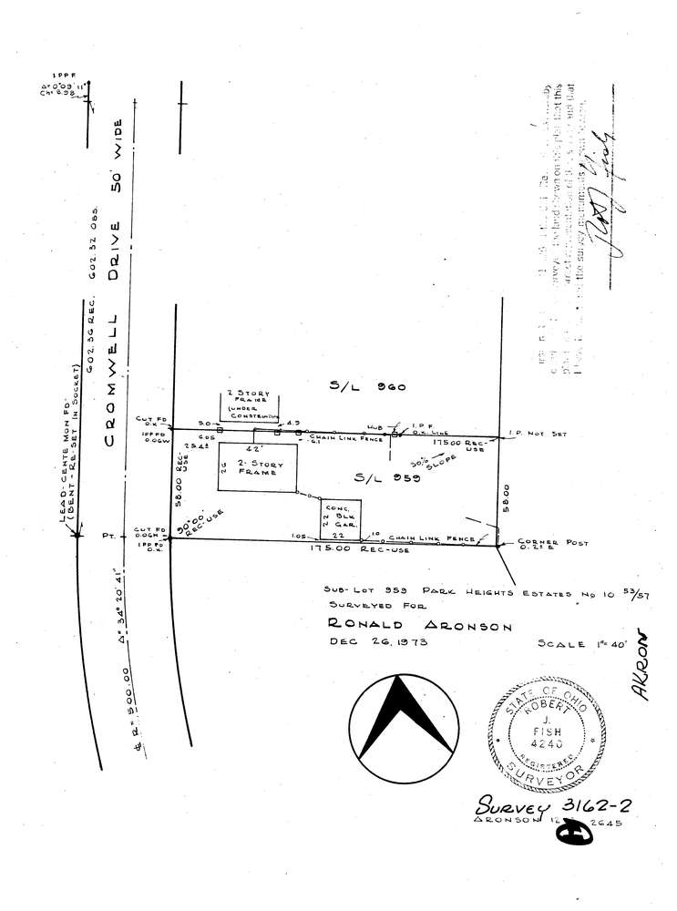
3162-2
Download lotsplits3162_2.tif
GIS Data
Latitude:
41.1267909999999
Longitude:
-81.572027
Identification
Survey identifier:
3162-2
Context
Original township:
Akron
Community list:
Akron
Surveyed on:
12/26/1973
Description
Owner:
Aronson
Description:
Sublot 959 Park Heights Estates
Primary road:
Cromwell Dr
Secondary road:
Near intersection:
Zahn Dr
Acreage:
Survey Locators
Tract list:
Lot list:
Section list:
Quarter:
Surveyor
Surveyor number:
4240
Surveyor name:
Fish, Robert J.
Company:
Document Data
Scan File Name:
lotsplits3162_2.tif
Scan Pages:
1
Drawer location: