Toggle navigation
Survey Documents
Advanced Search
Supporting Data
Companies
Surveyors
Communities
Original Townships
APIs
Survey Documents API
Tutorial
About
Contact
Search
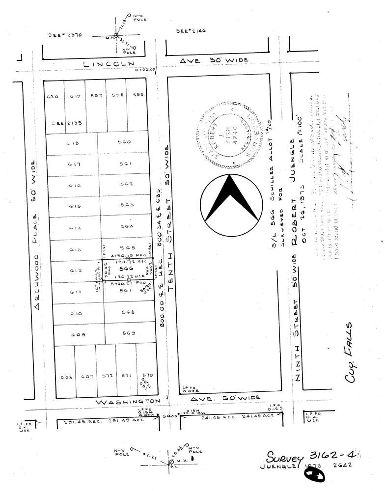
3162-4
Download lotsplits3162_4.tif
GIS Data
Latitude:
41.1475489999999
Longitude:
-81.494737
Identification
Survey identifier:
3162-4
Context
Original township:
Cuyahoga Falls
Community list:
Cuyahoga Falls
Surveyed on:
10/26/1973
Description
Owner:
Juengle
Description:
Sublot 566 Schiller Allotment
Primary road:
Tenth St
Secondary road:
Near intersection:
Washington Ave
Acreage:
Survey Locators
Tract list:
Lot list:
Section list:
Quarter:
Surveyor
Surveyor number:
4240
Surveyor name:
Fish, Robert J.
Company:
Document Data
Scan File Name:
lotsplits3162_4.tif
Scan Pages:
1
Drawer location: