Toggle navigation
Survey Documents
Advanced Search
Supporting Data
Companies
Surveyors
Communities
Original Townships
APIs
Survey Documents API
Tutorial
About
Contact
Search
10122
Download gr_s_337.tif
GIS Data
Latitude:
40.9207609999999
Longitude:
-81.525249
Identification
Survey identifier:
10122
Context
Original township:
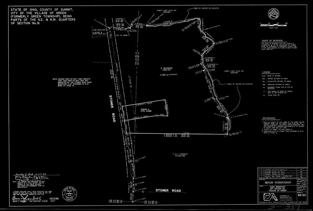
Green
Community list:
Green
Surveyed on:
10/22/1993
Description
Owner:
Wilkinson
Description:
Primary road:
Stoner Rd
Secondary road:
Near intersection:
E Comet Rd
Acreage:
Survey Locators
Tract list:
Lot list:
Section list:
31
Quarter:
Surveyor
Surveyor number:
5096
Surveyor name:
Campbell, Bruce J.
Company:
Document Data
Scan File Name:
gr_s_337.tif
Scan Pages:
1
Drawer location:
239