Toggle navigation
Survey Documents
Advanced Search
Supporting Data
Companies
Surveyors
Communities
Original Townships
APIs
Survey Documents API
Tutorial
About
Contact
Search
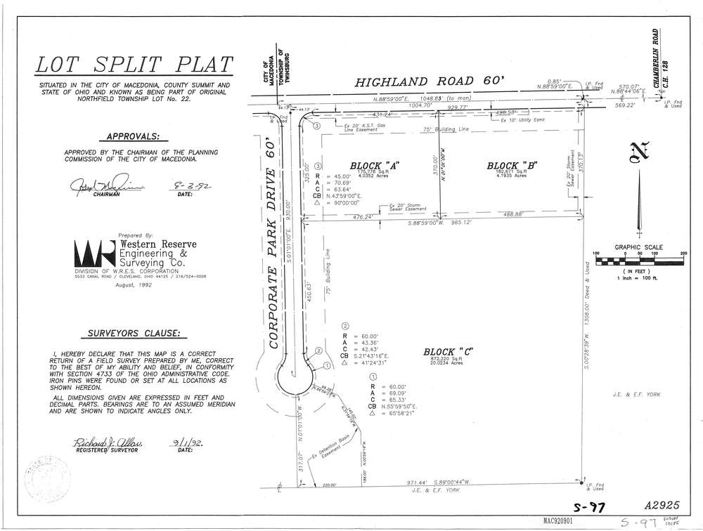
10185
Download Survey-10185.tif
GIS Data
Latitude:
41.2967029999999
Longitude:
-81.476026
Identification
Survey identifier:
10185
Context
Original township:
Northfield
Community list:
Twinsburg
Surveyed on:
09/01/1992
Description
Owner:
Description:
Primary road:
Corporate Park Dr
Secondary road:
Highland Rd
Near intersection:
Chamberlain Rd
Acreage:
Survey Locators
Tract list:
Lot list:
22
Section list:
Quarter:
Surveyor
Surveyor number:
5149
Surveyor name:
Allar, Richard J.
Company:
Western Reserve
Document Data
Scan File Name:
Survey-10185.tif
Scan Pages:
1
Drawer location:
249