Toggle navigation
Survey Documents
Advanced Search
Supporting Data
Companies
Surveyors
Communities
Original Townships
APIs
Survey Documents API
Tutorial
About
Contact
Search
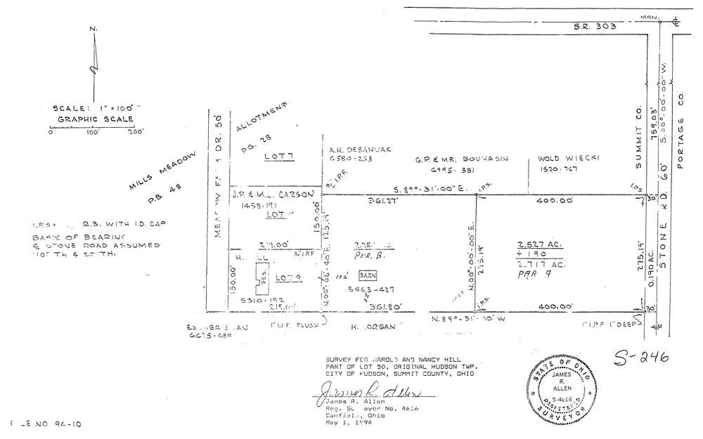
10241
Download hu_s_246.tif
GIS Data
Latitude:
41.2344459999998
Longitude:
-81.394958
Identification
Survey identifier:
10241
Context
Original township:
Hudson
Community list:
Hudson
Surveyed on:
05/01/1994
Description
Owner:
Hill
Description:
Primary road:
Stone Rd
Secondary road:
Meadow Farm Dr
Near intersection:
Streetsboro Rd
Acreage:
Survey Locators
Tract list:
Lot list:
Section list:
Quarter:
Surveyor
Surveyor number:
4616
Surveyor name:
Allen, James R.
Company:
Document Data
Scan File Name:
hu_s_246.tif
Scan Pages:
1
Drawer location:
240