Toggle navigation
Survey Documents
Advanced Search
Supporting Data
Companies
Surveyors
Communities
Original Townships
APIs
Survey Documents API
Tutorial
About
Contact
Search
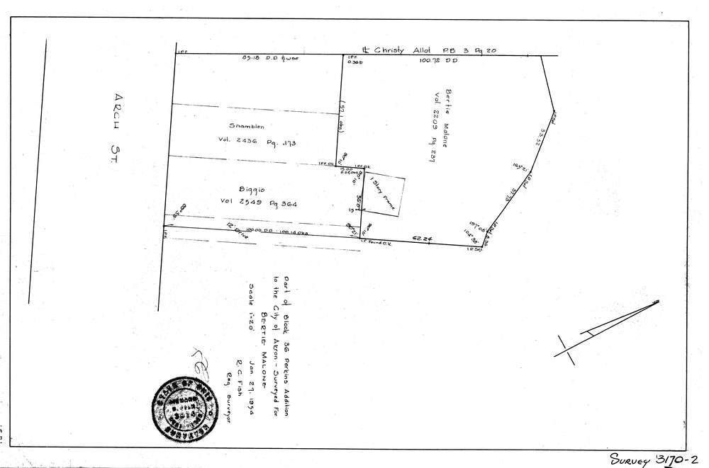
3170-2
Download lotsplits3170_2.tif
GIS Data
Latitude:
41.0851409999998
Longitude:
-81.500557
Identification
Survey identifier:
3170-2
Context
Original township:
Springfield
Community list:
Akron
Surveyed on:
Description
Owner:
Malone
Description:
Part Of Block 36 Perkins Addition To The City Of Akron
Primary road:
Arch St
Secondary road:
Near intersection:
Perkins St
Acreage:
Survey Locators
Tract list:
Lot list:
Section list:
Quarter:
Surveyor
Surveyor number:
3874
Surveyor name:
Fish, R.C.
Company:
Document Data
Scan File Name:
lotsplits3170_2.tif
Scan Pages:
1
Drawer location: